Opelika geodata
Opelika (Alabama) is a seat of a second-order administrative division; located in United States in America/Chicago (GMT-5) time zone. With population of 29,527 people, there are 1689 cities with bigger population in this country. Compared to other cities in United States, 86.6% of cities are located further ↑North; 54.9% of cities are located further ←West and 63.3% of cities have lower elevation than Opelika. Note1


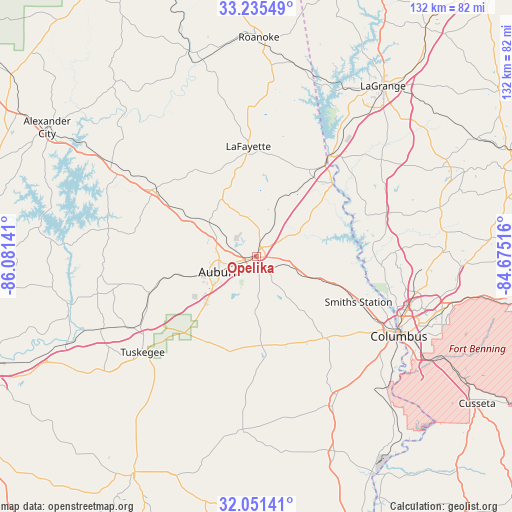
Opelika GPS coordinates[2]
32° 38' 43.476" North, 85° 22' 41.808" West
| Map corner | latitude | longitude |
|---|---|---|
| Upper-left | 33.23549°, | -86.08141° |
| Center: | 32.64541°, | -85.37828° |
| Lower-right: | 32.05141°, | -84.67516° |
| Map W x H: | 131.7×131.7 km | = 81.8×81.8mi |
| max Lat: | 71.29058° ⇑86.6% North |
| Opelika: | 32.64541° |
| min Lat: | ⇓13.4% South 19.06759° |
| min Long | Opelika | max Long |
| -171.73463° | -85.37828° | -66.98998° |
| W 54.9%⇐ | ⇒45.1% E |
Elevation
Elevation of Opelika is 254 m = 833 ft, and this is 40.8 m = 134 ft below average elevation for this country.
| Max E: |
3189 m = 10463 ft | 36.7% |
| Avg. | 294.8 m = 967 ft | |
| Opelika | 254 m = 833 ft | |
Min E: |
-60 m = -197 ft | 63.3% |
See also: United States elevation on elevation.city.
Geographical zone
Opelika is located in North temperate zone (between Tropic of Cancer and the Arctic Circle). Distance of this Northern Tropic circle is 1023.9 km =636.2 mi to South.| Distance of | km | miles | from Opelika |
|---|---|---|---|
| North Pole | 6377.2 | 3962.6 | to North |
| Arctic Circle | 3771.3 | 2343.4 | to North |
| Tropic Cancer | 1023.9 | 636.2 | to South |
| Equator | 3629.8 | 2255.5 | to South |


Nearby cities:
15 places around Opelika: (largest is in red/bold)
• Auburn
10.4 km =6.5 mi,  247°
247°
• Bibb City
39.8 km =24.7 mi,  114°
114°
• Camp Hill
31 km =19.3 mi,  303°
303°
• Dadeville
41.5 km =25.8 mi, 299°
• Huguley
25.2 km =15.7 mi,  33°
33°
• Ladonia
34.3 km =21.3 mi,  125°
125°
• Lafayette
28.4 km =17.6 mi,  355°
355°
• Lanett
30.4 km =18.9 mi,  35°
35°
• Notasulga
29.1 km =18.1 mi, 251°
• Phenix City
40.3 km =25 mi,  118°
118°
• Reeltown
40.3 km =25 mi,  263°
263°
• Smiths Station
28.7 km =17.8 mi, 114°
• Tuskegee
38.3 km =23.8 mi,  229°
229°
• Valley
26.8 km =16.7 mi, 43°
• West Point
31.6 km =19.6 mi, 35°
Sources, notices
• [Note1] Compared only with cities in United States existing in our database
• [Src1] Map data: © OpenStreetMap contributors (CC-BY-SA)
• [Src2] Other city data from geonames.org with taken over terms of usage.
• [Src3] Geographical zone / Annual Mean Temperature by Robert A. Rohde @ Wikipedia
