Tuskegee geodata
Tuskegee (Alabama) is a seat of a second-order administrative division; located in United States in America/Chicago (GMT-5) time zone. With population of 8,817 people, there are 4880 cities with bigger population in this country. Compared to other cities in United States, 87.4% of cities are located further ↑North; 53.8% of cities are located further ←West and 61.5% of cities have higher elevation than Tuskegee. Note1


Tuskegee GPS coordinates[2]
32° 25' 26.94" North, 85° 41' 27.456" West
| Map corner | latitude | longitude |
|---|---|---|
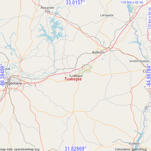
| Upper-left | 33.0157°, | -86.39409° |
| Center: | 32.42415°, | -85.69096° |
| Lower-right: | 31.82869°, | -84.98784° |
| Map W x H: | 132×132 km | = 82×82mi |
| max Lat: | 71.29058° ⇑87.4% North |
| Tuskegee: | 32.42415° |
| min Lat: | ⇓12.6% South 19.06759° |
| min Long | Tuskegee | max Long |
| -171.73463° | -85.69096° | -66.98998° |
| W 53.8%⇐ | ⇒46.2% E |
Elevation
Elevation of Tuskegee is 147 m = 482 ft, and this is 147.8 m = 485 ft below average elevation for this country.
| Max E: |
3189 m = 10463 ft | 61.5% |
| Avg. | 294.8 m = 967 ft | |
| Tuskegee | 147 m = 482 ft | |
Min E: |
-60 m = -197 ft | 38.5% |
See also: United States elevation on elevation.city.
Geographical zone
Tuskegee is located in North temperate zone (between Tropic of Cancer and the Arctic Circle). Distance of this Northern Tropic circle is 999.3 km =620.9 mi to South.| Distance of | km | miles | from Tuskegee |
|---|---|---|---|
| North Pole | 6401.8 | 3977.9 | to North |
| Arctic Circle | 3795.9 | 2358.7 | to North |
| Tropic Cancer | 999.3 | 620.9 | to South |
| Equator | 3605.2 | 2240.2 | to South |


Nearby cities:
15 places around Tuskegee: (largest is in red/bold)
• Auburn
28.5 km =17.7 mi,  43°
43°
• Blue Ridge
47.5 km =29.5 mi,  279°
279°
• Camp Hill
42 km =26.1 mi,  4°
4°
• Dadeville
45.8 km =28.5 mi,  351°
351°
• Eclectic
39.9 km =24.8 mi,  306°
306°
• Emerald Mountain
37.9 km =23.5 mi,  273°
273°
• Hurtsboro
32.8 km =20.4 mi,  128°
128°
• Inverness
45.8 km =28.5 mi,  186°
186°
• Matthews
34.3 km =21.3 mi,  239°
239°
• Notasulga
15.3 km =9.5 mi,  6°
6°
• Opelika
38.3 km =23.8 mi,  49°
49°
• Pike Road
41.7 km =25.9 mi,  248°
248°
• Reeltown
22.7 km =14.1 mi,  331°
331°
• Tallassee
22.7 km =14.1 mi,  303°
303°
• Union Springs
31.2 km =19.4 mi,  184°
184°
Sources, notices
• [Note1] Compared only with cities in United States existing in our database
• [Src1] Map data: © OpenStreetMap contributors (CC-BY-SA)
• [Src2] Other city data from geonames.org with taken over terms of usage.
• [Src3] Geographical zone / Annual Mean Temperature by Robert A. Rohde @ Wikipedia
