Notasulga geodata
Notasulga (Alabama) is a populated place; located in United States in America/Chicago (GMT-5) time zone. With population of 856 people, there are 17325 cities with bigger population in this country. Compared to other cities in United States, 86.9% of cities are located further ↑North; 53.9% of cities are located further ←West and 58.6% of cities have higher elevation than Notasulga. Note1


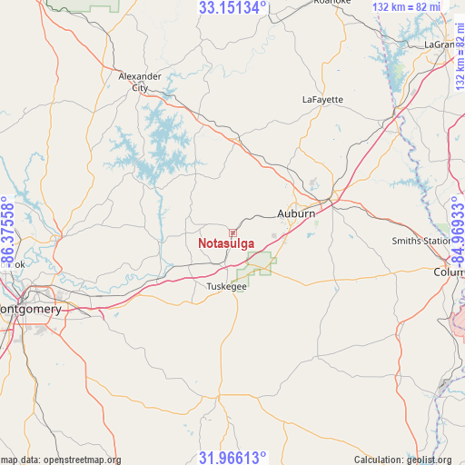
Notasulga GPS coordinates[2]
32° 33' 38.484" North, 85° 40' 20.82" West
| Map corner | latitude | longitude |
|---|---|---|
| Upper-left | 33.15134°, | -86.37558° |
| Center: | 32.56069°, | -85.67245° |
| Lower-right: | 31.96613°, | -84.96933° |
| Map W x H: | 131.8×131.8 km | = 81.9×81.9mi |
| max Lat: | 71.29058° ⇑86.9% North |
| Notasulga: | 32.56069° |
| min Lat: | ⇓13.1% South 19.06759° |
| min Long | Notasulga | max Long |
| -171.73463° | -85.67245° | -66.98998° |
| W 53.9%⇐ | ⇒46.1% E |
Elevation
Elevation of Notasulga is 162 m = 531 ft, and this is 132.8 m = 436 ft below average elevation for this country.
| Max E: |
3189 m = 10463 ft | 58.6% |
| Avg. | 294.8 m = 967 ft | |
| Notasulga | 162 m = 531 ft | |
Min E: |
-60 m = -197 ft | 41.4% |
See also: United States elevation on elevation.city.
Geographical zone
Notasulga is located in North temperate zone (between Tropic of Cancer and the Arctic Circle). Distance of this Northern Tropic circle is 1014.5 km =630.4 mi to South.| Distance of | km | miles | from Notasulga |
|---|---|---|---|
| North Pole | 6386.7 | 3968.5 | to North |
| Arctic Circle | 3780.8 | 2349.3 | to North |
| Tropic Cancer | 1014.5 | 630.4 | to South |
| Equator | 3620.4 | 2249.6 | to South |


Nearby cities:
15 places around Notasulga: (largest is in red/bold)
• Auburn
18.8 km =11.7 mi,  73°
73°
• Camp Hill
26.7 km =16.6 mi,  3°
3°
• Dadeville
31.3 km =19.4 mi,  344°
344°
• Eclectic
34.9 km =21.7 mi,  283°
283°
• Emerald Mountain
41.5 km =25.8 mi,  252°
252°
• Hurtsboro
42.8 km =26.6 mi,  145°
145°
• Jacksons Gap
38.5 km =23.9 mi, 340°
• Lafayette
45.5 km =28.3 mi,  33°
33°
• Matthews
45.2 km =28.1 mi,  223°
223°
• Opelika
29.1 km =18.1 mi, 71°
• Our Town
40.2 km =25 mi,  317°
317°
• Reeltown
13.3 km =8.3 mi,  291°
291°
• Tallassee
20.9 km =13 mi,  262°
262°
• Tuskegee
15.3 km =9.5 mi,  186°
186°
• Union Springs
46.5 km =28.9 mi,  184°
184°
Sources, notices
• [Note1] Compared only with cities in United States existing in our database
• [Src1] Map data: © OpenStreetMap contributors (CC-BY-SA)
• [Src2] Other city data from geonames.org with taken over terms of usage.
• [Src3] Geographical zone / Annual Mean Temperature by Robert A. Rohde @ Wikipedia
