Baconton geodata
Baconton (Georgia) is a populated place; located in United States in America/New_York (GMT-4) time zone. With population of 871 people, there are 17188 cities with bigger population in this country. Compared to other cities in United States, 89.9% of cities are located further ↑North; 58.8% of cities are located further ←West and 76.9% of cities have higher elevation than Baconton. Note1


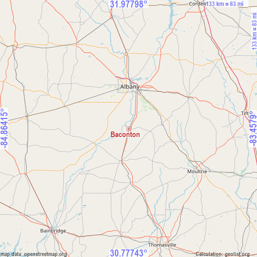
Baconton GPS coordinates[2]
31° 22' 46.632" North, 84° 9' 39.672" West
| Map corner | latitude | longitude |
|---|---|---|
| Upper-left | 31.97798°, | -84.86415° |
| Center: | 31.37962°, | -84.16102° |
| Lower-right: | 30.77743°, | -83.4579° |
| Map W x H: | 133.5×133.5 km | = 83×83mi |
| max Lat: | 71.29058° ⇑89.9% North |
| Baconton: | 31.37962° |
| min Lat: | ⇓10.1% South 19.06759° |
| min Long | Baconton | max Long |
| -171.73463° | -84.16102° | -66.98998° |
| W 58.8%⇐ | ⇒41.2% E |
Elevation
Elevation of Baconton is 61 m = 200 ft, and this is 233.8 m = 767 ft below average elevation for this country.
| Max E: |
3189 m = 10463 ft | 76.9% |
| Avg. | 294.8 m = 967 ft | |
| Baconton | 61 m = 200 ft | |
Min E: |
-60 m = -197 ft | 23.1% |
See also: United States elevation on elevation.city.
Geographical zone
Baconton is located in North temperate zone (between Tropic of Cancer and the Arctic Circle). Distance of this Northern Tropic circle is 883.2 km =548.8 mi to South.| Distance of | km | miles | from Baconton |
|---|---|---|---|
| North Pole | 6518 | 4050.1 | to North |
| Arctic Circle | 3912.1 | 2430.9 | to North |
| Tropic Cancer | 883.2 | 548.8 | to South |
| Equator | 3489.1 | 2168 | to South |


Nearby cities:
15 places around Baconton: (largest is in red/bold)
• Albany
22.1 km =13.7 mi,  1°
1°
• Camilla
17.1 km =10.6 mi,  195°
195°
• Doerun
24.1 km =15 mi,  106°
106°
• Leary
35.5 km =22.1 mi,  289°
289°
• Leesburg
39.2 km =24.4 mi,  358°
358°
• Meigs
34.8 km =21.6 mi,  168°
168°
• Morgan
45.1 km =28 mi, 292°
• Moultrie
41.7 km =25.9 mi,  122°
122°
• Newton
18.2 km =11.3 mi,  245°
245°
• Norman Park
46.7 km =29 mi, 105°
• Ochlocknee
46.2 km =28.7 mi, 167°
• Pelham
28 km =17.4 mi,  178°
178°
• Poulan
38.4 km =23.9 mi,  67°
67°
• Putney
10.9 km =6.8 mi,  22°
22°
• Sylvester
35 km =21.7 mi,  61°
61°
Sources, notices
• [Note1] Compared only with cities in United States existing in our database
• [Src1] Map data: © OpenStreetMap contributors (CC-BY-SA)
• [Src2] Other city data from geonames.org with taken over terms of usage.
• [Src3] Geographical zone / Annual Mean Temperature by Robert A. Rohde @ Wikipedia
