Morgan geodata
Morgan (Georgia) is a seat of a second-order administrative division; located in United States in America/New_York (GMT-4) time zone. With population of 1,849 people, there are 12373 cities with bigger population in this country. Compared to other cities in United States, 89.6% of cities are located further ↑North; 57% of cities are located further ←West and 73.3% of cities have higher elevation than Morgan. Note1


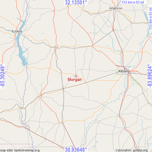
Morgan GPS coordinates[2]
31° 32' 15.612" North, 84° 35' 57.696" West
| Map corner | latitude | longitude |
|---|---|---|
| Upper-left | 32.13501°, | -85.30249° |
| Center: | 31.53767°, | -84.59936° |
| Lower-right: | 30.93648°, | -83.89624° |
| Map W x H: | 133.3×133.3 km | = 82.8×82.8mi |
| max Lat: | 71.29058° ⇑89.6% North |
| Morgan: | 31.53767° |
| min Lat: | ⇓10.4% South 19.06759° |
| min Long | Morgan | max Long |
| -171.73463° | -84.59936° | -66.98998° |
| W 57%⇐ | ⇒43% E |
Elevation
Elevation of Morgan is 81 m = 266 ft, and this is 213.8 m = 701 ft below average elevation for this country.
| Max E: |
3189 m = 10463 ft | 73.3% |
| Avg. | 294.8 m = 967 ft | |
| Morgan | 81 m = 266 ft | |
Min E: |
-60 m = -197 ft | 26.7% |
See also: United States elevation on elevation.city.
Geographical zone
Morgan is located in North temperate zone (between Tropic of Cancer and the Arctic Circle). Distance of this Northern Tropic circle is 900.7 km =559.7 mi to South.| Distance of | km | miles | from Morgan |
|---|---|---|---|
| North Pole | 6500.4 | 4039.2 | to North |
| Arctic Circle | 3894.5 | 2419.9 | to North |
| Tropic Cancer | 900.7 | 559.7 | to South |
| Equator | 3506.7 | 2179 | to South |


Nearby cities:
15 places around Morgan: (largest is in red/bold)
• Albany
42.3 km =26.3 mi,  83°
83°
• Arlington
16.1 km =10 mi,  227°
227°
• Baconton
45.1 km =28 mi,  112°
112°
• Blakely
36.4 km =22.6 mi,  240°
240°
• Camilla
50.2 km =31.2 mi,  132°
132°
• Colquitt
42.7 km =26.5 mi,  197°
197°
• Cuthbert
31.6 km =19.6 mi,  325°
325°
• Dawson
29.9 km =18.6 mi,  28°
28°
• Edison
13.4 km =8.3 mi,  279°
279°
• Fort Gaines
43.4 km =27 mi, 280°
• Leary
10 km =6.2 mi, 125°
• Leesburg
46 km =28.6 mi,  61°
61°
• Newton
35.4 km =22 mi, 134°
• Putney
46.3 km =28.8 mi,  99°
99°
• Shellman
24.4 km =15.2 mi,  356°
356°
Sources, notices
• [Note1] Compared only with cities in United States existing in our database
• [Src1] Map data: © OpenStreetMap contributors (CC-BY-SA)
• [Src2] Other city data from geonames.org with taken over terms of usage.
• [Src3] Geographical zone / Annual Mean Temperature by Robert A. Rohde @ Wikipedia
