Lyons geodata
Lyons (Kansas) is a seat of a second-order administrative division; located in United States in America/Chicago (GMT-5) time zone. With population of 3,725 people, there are 8555 cities with bigger population in this country. Compared to other cities in United States, 59.7% of cities are located further ↑North; 78.9% of cities are located further →East and 88.3% of cities have lower elevation than Lyons. Note1


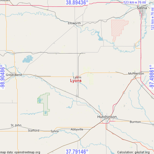
Lyons GPS coordinates[2]
38° 20' 42.036" North, 98° 12' 6.228" West
| Map corner | latitude | longitude |
|---|---|---|
| Upper-left | 38.89436°, | -98.90486° |
| Center: | 38.34501°, | -98.20173° |
| Lower-right: | 37.79146°, | -97.49861° |
| Map W x H: | 122.6×122.6 km | = 76.2×76.2mi |
| max Lat: | 71.29058° ⇑59.7% North |
| Lyons: | 38.34501° |
| min Lat: | ⇓40.3% South 19.06759° |
| min Long | Lyons | max Long |
| -171.73463° | -98.20173° | -66.98998° |
| W 21.1%⇐ | ⇒78.9% E |
Elevation
Elevation of Lyons is 520 m = 1706 ft, and this is 225.2 m = 739 ft above average elevation for this country.
| Max E: |
3189 m = 10463 ft | 11.7% |
| Lyons | 520 m 1706 ft | |
| Avg. | 294.8 m = 967 ft | |
Min E: |
-60 m = -197 ft | 88.3% |
See also: United States elevation on elevation.city.
Geographical zone
Lyons is located in North temperate zone (between Tropic of Cancer and the Arctic Circle). Distance of this Northern Tropic circle is 1657.6 km =1030 mi to South.| Distance of | km | miles | from Lyons |
|---|---|---|---|
| North Pole | 5743.5 | 3568.8 | to North |
| Arctic Circle | 3137.6 | 1949.6 | to North |
| Tropic Cancer | 1657.6 | 1030 | to South |
| Equator | 4263.6 | 2649.3 | to South |


Nearby cities:
15 places around Lyons: (largest is in red/bold)
• Buhler
44.4 km =27.6 mi,  121°
121°
• Claflin
35.2 km =21.9 mi,  304°
304°
• Ellinwood
33.1 km =20.6 mi,  272°
272°
• Ellsworth
42.9 km =26.7 mi,  356°
356°
• Great Bend
49.1 km =30.5 mi, 272°
• Hoisington
53.8 km =33.4 mi,  290°
290°
• Hutchinson
39.5 km =24.5 mi,  143°
143°
• Inman
39.4 km =24.5 mi,  108°
108°
• Lindsborg
52.5 km =32.6 mi,  61°
61°
• Little River
17.6 km =10.9 mi,  70°
70°
• Marquette
39.7 km =24.7 mi,  53°
53°
• McPherson
47 km =29.2 mi,  86°
86°
• Nickerson
24.3 km =15.1 mi,  154°
154°
• South Hutchinson
42 km =26.1 mi, 147°
• Sterling
15 km =9.3 mi,  181°
181°
Sources, notices
• [Note1] Compared only with cities in United States existing in our database
• [Src1] Map data: © OpenStreetMap contributors (CC-BY-SA)
• [Src2] Other city data from geonames.org with taken over terms of usage.
• [Src3] Geographical zone / Annual Mean Temperature by Robert A. Rohde @ Wikipedia
