Gorman geodata
Gorman (North Carolina) is a populated place; located in United States in America/New_York (GMT-4) time zone. With population of 1,011 people, there are 16213 cities with bigger population in this country. Compared to other cities in United States, 70.3% of cities are located further ↑North; 76.2% of cities are located further ←West and 68.3% of cities have higher elevation than Gorman. Note1
Administrative division(s):
- Level 1: North Carolina
- Level 2: Durham County
- Level 3: Township of Oak Grove


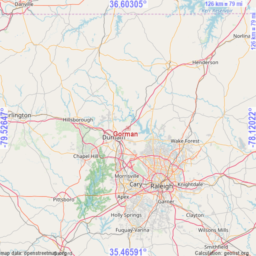
Gorman GPS coordinates[2]
36° 2' 11.508" North, 78° 49' 24.024" West
| Map corner | latitude | longitude |
|---|---|---|
| Upper-left | 36.60305°, | -79.52647° |
| Center: | 36.03653°, | -78.82334° |
| Lower-right: | 35.46591°, | -78.12022° |
| Map W x H: | 126.4×126.4 km | = 78.5×78.5mi |
| max Lat: | 71.29058° ⇑70.3% North |
| Gorman: | 36.03653° |
| min Lat: | ⇓29.7% South 19.06759° |
| min Long | Gorman | max Long |
| -171.73463° | -78.82334° | -66.98998° |
| W 76.2%⇐ | ⇒23.8% E |
Elevation
Elevation of Gorman is 111 m = 364 ft, and this is 183.8 m = 603 ft below average elevation for this country.
| Max E: |
3189 m = 10463 ft | 68.3% |
| Avg. | 294.8 m = 967 ft | |
| Gorman | 111 m = 364 ft | |
Min E: |
-60 m = -197 ft | 31.7% |
See also: United States elevation on elevation.city.
Geographical zone
Gorman is located in North temperate zone (between Tropic of Cancer and the Arctic Circle). Distance of this Northern Tropic circle is 1401 km =870.5 mi to South.| Distance of | km | miles | from Gorman |
|---|---|---|---|
| North Pole | 6000.2 | 3728.4 | to North |
| Arctic Circle | 3394.3 | 2109.1 | to North |
| Tropic Cancer | 1401 | 870.5 | to South |
| Equator | 4006.9 | 2489.8 | to South |


Nearby cities:
15 places around Gorman: (largest is in red/bold)
• Butner
12.2 km =7.6 mi,  29°
29°
• Carrboro
26.7 km =16.6 mi,  238°
238°
• Cary
27.5 km =17.1 mi,  172°
172°
• Chapel Hill
25 km =15.5 mi, 236°
• Creedmoor
15.6 km =9.7 mi,  52°
52°
• Durham
8.3 km =5.2 mi, 235°
• Efland
31.5 km =19.6 mi,  279°
279°
• Franklinton
33.6 km =20.9 mi,  77°
77°
• Green Level
29.2 km =18.1 mi,  194°
194°
• Hillsborough
25.2 km =15.7 mi, 279°
• Morrisville
23.7 km =14.7 mi,  180°
180°
• Rougemont
22.2 km =13.8 mi,  335°
335°
• Wake Forest
28.9 km =18 mi,  102°
102°
• West Raleigh
31.3 km =19.4 mi,  152°
152°
• Youngsville
31.4 km =19.5 mi,  92°
92°
Sources, notices
• [Note1] Compared only with cities in United States existing in our database
• [Src1] Map data: © OpenStreetMap contributors (CC-BY-SA)
• [Src2] Other city data from geonames.org with taken over terms of usage.
• [Src3] Geographical zone / Annual Mean Temperature by Robert A. Rohde @ Wikipedia
