Wake Forest geodata
Wake Forest (North Carolina) is a populated place; located in United States in America/New_York (GMT-4) time zone. With population of 38,199 people, there are 1268 cities with bigger population in this country. Compared to other cities in United States, 70.5% of cities are located further ↑North; 76.9% of cities are located further ←West and 66.6% of cities have higher elevation than Wake Forest. Note1
Administrative division(s):
- Level 1: North Carolina
- Level 2: Wake County
- Level 3: Township of Wake Forest


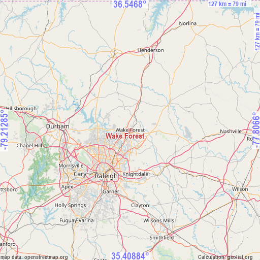
Wake Forest GPS coordinates[2]
35° 58' 47.532" North, 78° 30' 34.992" West
| Map corner | latitude | longitude |
|---|---|---|
| Upper-left | 36.5468°, | -79.21285° |
| Center: | 35.97987°, | -78.50972° |
| Lower-right: | 35.40884°, | -77.8066° |
| Map W x H: | 126.5×126.5 km | = 78.6×78.6mi |
| max Lat: | 71.29058° ⇑70.5% North |
| Wake Forest: | 35.97987° |
| min Lat: | ⇓29.5% South 19.06759° |
| min Long | Wake Forest | max Long |
| -171.73463° | -78.50972° | -66.98998° |
| W 76.9%⇐ | ⇒23.1% E |
Elevation
Elevation of Wake Forest is 120 m = 394 ft, and this is 174.8 m = 573 ft below average elevation for this country.
| Max E: |
3189 m = 10463 ft | 66.6% |
| Avg. | 294.8 m = 967 ft | |
| Wake Forest | 120 m = 394 ft | |
Min E: |
-60 m = -197 ft | 33.4% |
See also: United States elevation on elevation.city.
Geographical zone
Wake Forest is located in North temperate zone (between Tropic of Cancer and the Arctic Circle). Distance of this Northern Tropic circle is 1394.7 km =866.6 mi to South.| Distance of | km | miles | from Wake Forest |
|---|---|---|---|
| North Pole | 6006.5 | 3732.3 | to North |
| Arctic Circle | 3400.6 | 2113 | to North |
| Tropic Cancer | 1394.7 | 866.6 | to South |
| Equator | 4000.6 | 2485.9 | to South |


Nearby cities:
15 places around Wake Forest: (largest is in red/bold)
• Butner
27.9 km =17.3 mi,  307°
307°
• Cary
32.2 km =20 mi,  229°
229°
• Creedmoor
22.4 km =13.9 mi, 314°
• Franklinton
14.3 km =8.9 mi,  18°
18°
• Garner
31.3 km =19.4 mi,  197°
197°
• Gorman
28.9 km =18 mi,  282°
282°
• Knightdale
21.5 km =13.4 mi,  172°
172°
• Louisburg
23 km =14.3 mi,  54°
54°
• Morrisville
33.3 km =20.7 mi,  238°
238°
• Raleigh
25.9 km =16.1 mi,  206°
206°
• Rolesville
7.9 km =4.9 mi,  143°
143°
• Wendell
25.5 km =15.8 mi,  150°
150°
• West Raleigh
25.6 km =15.9 mi, 212°
• Youngsville
5.9 km =3.7 mi,  32°
32°
• Zebulon
24.6 km =15.3 mi,  134°
134°
Sources, notices
• [Note1] Compared only with cities in United States existing in our database
• [Src1] Map data: © OpenStreetMap contributors (CC-BY-SA)
• [Src2] Other city data from geonames.org with taken over terms of usage.
• [Src3] Geographical zone / Annual Mean Temperature by Robert A. Rohde @ Wikipedia
