Allen geodata
Allen (Oklahoma) is a populated place; located in United States in America/Chicago (GMT-5) time zone. With population of 935 people, there are 16755 cities with bigger population in this country. Compared to other cities in United States, 76% of cities are located further ↑North; 74.3% of cities are located further →East and 66.7% of cities have lower elevation than Allen. Note1


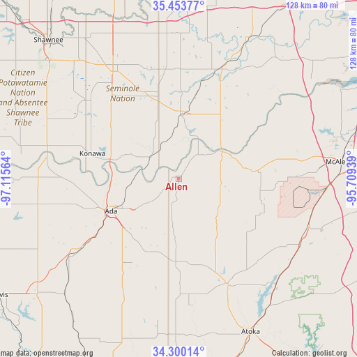
Allen GPS coordinates[2]
34° 52' 44.328" North, 96° 24' 45.036" West
| Map corner | latitude | longitude |
|---|---|---|
| Upper-left | 35.45377°, | -97.11564° |
| Center: | 34.87898°, | -96.41251° |
| Lower-right: | 34.30014°, | -95.70939° |
| Map W x H: | 128.3×128.3 km | = 79.7×79.7mi |
| max Lat: | 71.29058° ⇑76% North |
| Allen: | 34.87898° |
| min Lat: | ⇓24% South 19.06759° |
| min Long | Allen | max Long |
| -171.73463° | -96.41251° | -66.98998° |
| W 25.7%⇐ | ⇒74.3% E |
Elevation
Elevation of Allen is 270 m = 886 ft, and this is 24.8 m = 81 ft below average elevation for this country.
| Max E: |
3189 m = 10463 ft | 33.3% |
| Avg. | 294.8 m = 967 ft | |
| Allen | 270 m = 886 ft | |
Min E: |
-60 m = -197 ft | 66.7% |
See also: United States elevation on elevation.city.
Geographical zone
Allen is located in North temperate zone (between Tropic of Cancer and the Arctic Circle). Distance of this Northern Tropic circle is 1272.3 km =790.6 mi to South.| Distance of | km | miles | from Allen |
|---|---|---|---|
| North Pole | 6128.9 | 3808.3 | to North |
| Arctic Circle | 3523 | 2189.1 | to North |
| Tropic Cancer | 1272.3 | 790.6 | to South |
| Equator | 3878.2 | 2409.8 | to South |


Nearby cities:
15 places around Allen: (largest is in red/bold)
• Ada
26.9 km =16.7 mi,  244°
244°
• Byng
23.2 km =14.4 mi,  265°
265°
• Coalgate
41.8 km =26 mi,  154°
154°
• Earlsboro
56 km =34.8 mi,  320°
320°
• Holdenville
22.4 km =13.9 mi,  3°
3°
• Kiowa
50.1 km =31.1 mi,  110°
110°
• Konawa
32.3 km =20.1 mi,  286°
286°
• Maud
43.3 km =26.9 mi,  310°
310°
• Roff
48.1 km =29.9 mi,  234°
234°
• Savanna
52.2 km =32.4 mi,  96°
96°
• Seminole
45 km =28 mi,  328°
328°
• Stratford
50.7 km =31.5 mi,  259°
259°
• Weleetka
56.6 km =35.2 mi,  26°
26°
• Wetumka
42.8 km =26.6 mi,  21°
21°
• Wewoka
32 km =19.9 mi,  346°
346°
Sources, notices
• [Note1] Compared only with cities in United States existing in our database
• [Src1] Map data: © OpenStreetMap contributors (CC-BY-SA)
• [Src2] Other city data from geonames.org with taken over terms of usage.
• [Src3] Geographical zone / Annual Mean Temperature by Robert A. Rohde @ Wikipedia
