Cache geodata
Cache (Oklahoma) is a populated place; located in United States in America/Chicago (GMT-5) time zone. With population of 2,925 people, there are 9761 cities with bigger population in this country. Compared to other cities in United States, 77.1% of cities are located further ↑North; 79.5% of cities are located further →East and 83.1% of cities have lower elevation than Cache. Note1


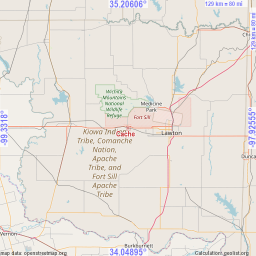
Cache GPS coordinates[2]
34° 37' 46.272" North, 98° 37' 43.212" West
| Map corner | latitude | longitude |
|---|---|---|
| Upper-left | 35.20606°, | -99.3318° |
| Center: | 34.62952°, | -98.62867° |
| Lower-right: | 34.04895°, | -97.92555° |
| Map W x H: | 128.7×128.7 km | = 80×80mi |
| max Lat: | 71.29058° ⇑77.1% North |
| Cache: | 34.62952° |
| min Lat: | ⇓22.9% South 19.06759° |
| min Long | Cache | max Long |
| -171.73463° | -98.62867° | -66.98998° |
| W 20.5%⇐ | ⇒79.5% E |
Elevation
Elevation of Cache is 392 m = 1286 ft, and this is 97.2 m = 319 ft above average elevation for this country.
| Max E: |
3189 m = 10463 ft | 16.9% |
| Cache | 392 m 1286 ft | |
| Avg. | 294.8 m = 967 ft | |
Min E: |
-60 m = -197 ft | 83.1% |
See also: United States elevation on elevation.city.
Geographical zone
Cache is located in North temperate zone (between Tropic of Cancer and the Arctic Circle). Distance of this Northern Tropic circle is 1244.5 km =773.3 mi to South.| Distance of | km | miles | from Cache |
|---|---|---|---|
| North Pole | 6156.6 | 3825.5 | to North |
| Arctic Circle | 3550.7 | 2206.3 | to North |
| Tropic Cancer | 1244.5 | 773.3 | to South |
| Equator | 3850.4 | 2392.5 | to South |


Nearby cities:
15 places around Cache: (largest is in red/bold)
• Apache
37.9 km =23.5 mi,  39°
39°
• Carnegie
52.8 km =32.8 mi,  2°
2°
• Central High
49.3 km =30.6 mi,  90°
90°
• Cyril
49.1 km =30.5 mi,  52°
52°
• Elgin
35 km =21.7 mi,  61°
61°
• Fletcher
41.2 km =25.6 mi, 58°
• Frederick
44.4 km =27.6 mi,  233°
233°
• Geronimo
27.9 km =17.3 mi,  126°
126°
• Grandfield
44.9 km =27.9 mi,  186°
186°
• Lawton
21.9 km =13.6 mi,  96°
96°
• Mountain View
53.1 km =33 mi,  348°
348°
• Snyder
29.7 km =18.5 mi,  276°
276°
• Sterling
43.9 km =27.3 mi,  72°
72°
• Tipton
49 km =30.4 mi,  253°
253°
• Walters
42 km =26.1 mi,  135°
135°
Sources, notices
• [Note1] Compared only with cities in United States existing in our database
• [Src1] Map data: © OpenStreetMap contributors (CC-BY-SA)
• [Src2] Other city data from geonames.org with taken over terms of usage.
• [Src3] Geographical zone / Annual Mean Temperature by Robert A. Rohde @ Wikipedia
