Crockett geodata
Crockett (Texas) is a seat of a second-order administrative division; located in United States in America/Chicago (GMT-5) time zone. With population of 6,554 people, there are 6075 cities with bigger population in this country. Compared to other cities in United States, 90% of cities are located further ↑North; 72.2% of cities are located further →East and 67.3% of cities have higher elevation than Crockett. Note1


Crockett GPS coordinates[2]
31° 19' 5.664" North, 95° 27' 23.796" West
| Map corner | latitude | longitude |
|---|---|---|
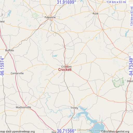
| Upper-left | 31.91699°, | -96.15974° |
| Center: | 31.31824°, | -95.45661° |
| Lower-right: | 30.71566°, | -94.75349° |
| Map W x H: | 133.6×133.6 km | = 83×83mi |
| max Lat: | 71.29058° ⇑90% North |
| Crockett: | 31.31824° |
| min Lat: | ⇓10% South 19.06759° |
| min Long | Crockett | max Long |
| -171.73463° | -95.45661° | -66.98998° |
| W 27.8%⇐ | ⇒72.2% E |
Elevation
Elevation of Crockett is 116 m = 381 ft, and this is 178.8 m = 587 ft below average elevation for this country.
| Max E: |
3189 m = 10463 ft | 67.3% |
| Avg. | 294.8 m = 967 ft | |
| Crockett | 116 m = 381 ft | |
Min E: |
-60 m = -197 ft | 32.7% |
See also: United States elevation on elevation.city.
Geographical zone
Crockett is located in North temperate zone (between Tropic of Cancer and the Arctic Circle). Distance of this Northern Tropic circle is 876.3 km =544.5 mi to South.| Distance of | km | miles | from Crockett |
|---|---|---|---|
| North Pole | 6524.8 | 4054.3 | to North |
| Arctic Circle | 3918.9 | 2435.1 | to North |
| Tropic Cancer | 876.3 | 544.5 | to South |
| Equator | 3482.3 | 2163.8 | to South |


Nearby cities:
15 places around Crockett: (largest is in red/bold)
• Alto
51.9 km =32.2 mi,  44°
44°
• Buffalo
59.3 km =36.8 mi,  285°
285°
• Centerville
50 km =31.1 mi,  262°
262°
• Cooper
14.6 km =9.1 mi,  235°
235°
• Elkhart
36.1 km =22.4 mi,  341°
341°
• Grapeland
19.4 km =12.1 mi,  353°
353°
• Groveton
43 km =26.7 mi,  132°
132°
• Hickory Creek
14.5 km =9 mi,  62°
62°
• Lovelady
21.3 km =13.2 mi,  177°
177°
• Oakwood
47.6 km =29.6 mi,  308°
308°
• Palestine
52 km =32.3 mi, 341°
• Riverside
52 km =32.3 mi,  174°
174°
• San Pedro
19.1 km =11.9 mi,  22°
22°
• Trinity
42.2 km =26.2 mi, 169°
• Wells
52.6 km =32.7 mi,  68°
68°
Sources, notices
• [Note1] Compared only with cities in United States existing in our database
• [Src1] Map data: © OpenStreetMap contributors (CC-BY-SA)
• [Src2] Other city data from geonames.org with taken over terms of usage.
• [Src3] Geographical zone / Annual Mean Temperature by Robert A. Rohde @ Wikipedia
