Fairfield geodata
Fairfield (Connecticut) is a populated place; located in United States in America/New_York (GMT-4) time zone. With population of 59,052 people, there are 765 cities with bigger population in this country. Compared to other cities in United States, 67.3% of cities are located further ↓South; 93.3% of cities are located further ←West and 98.1% of cities have higher elevation than Fairfield. Note1
Administrative division(s):
- Level 1: Connecticut
- Level 2: Fairfield County
- Level 3: Town of Fairfield


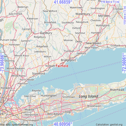
Fairfield GPS coordinates[2]
41° 8' 28.356" North, 73° 15' 49.428" West
| Map corner | latitude | longitude |
|---|---|---|
| Upper-left | 41.66859°, | -73.96686° |
| Center: | 41.14121°, | -73.26373° |
| Lower-right: | 40.60956°, | -72.56061° |
| Map W x H: | 117.8×117.8 km | = 73.2×73.2mi |
| max Lat: | 71.29058° ⇑32.7% North |
| Fairfield: | 41.14121° |
| min Lat: | ⇓67.3% South 19.06759° |
| min Long | Fairfield | max Long |
| -171.73463° | -73.26373° | -66.98998° |
| W 93.3%⇐ | ⇒6.7% E |
Elevation
Elevation of Fairfield is 5 m = 16 ft, and this is 289.8 m = 951 ft below average elevation for this country.
| Max E: |
3189 m = 10463 ft | 98.1% |
| Avg. | 294.8 m = 967 ft | |
| Fairfield | 5 m = 16 ft | |
Min E: |
-60 m = -197 ft | 1.9% |
See also: Fairfield elevation on elevation.city.
Geographical zone
Fairfield is located in North temperate zone (between Tropic of Cancer and the Arctic Circle). Distance of this Northern Tropic circle is 1968.6 km =1223.2 mi to South.| Distance of | km | miles | from Fairfield |
|---|---|---|---|
| North Pole | 5432.6 | 3375.7 | to North |
| Arctic Circle | 2826.7 | 1756.4 | to North |
| Tropic Cancer | 1968.6 | 1223.2 | to South |
| Equator | 4574.5 | 2842.5 | to South |


Nearby cities:
15 places around Fairfield: (largest is in red/bold)
• Bridgeport
7.5 km =4.7 mi,  55°
55°
• City of Milford (balance)
19.2 km =11.9 mi, 61°
• Darien
18.6 km =11.6 mi,  248°
248°
• East Norwalk
12 km =7.5 mi, 250°
• Easton
12.7 km =7.9 mi,  347°
347°
• Georgetown
19.2 km =11.9 mi,  311°
311°
• Milford
19.5 km =12.1 mi, 62°
• New Canaan
19.4 km =12.1 mi,  271°
271°
• Norwalk
12.4 km =7.7 mi,  257°
257°
• Old Field
23.1 km =14.4 mi,  150°
150°
• Southport
1.7 km =1.1 mi, 252°
• Stratford
11.9 km =7.4 mi,  66°
66°
• Trumbull
12.5 km =7.8 mi,  25°
25°
• Westport
7.9 km =4.9 mi, 270°
• Wilton
15.8 km =9.8 mi,  292°
292°
Sources, notices
• [Note1] Compared only with cities in United States existing in our database
• [Src1] Map data: © OpenStreetMap contributors (CC-BY-SA)
• [Src2] Other city data from geonames.org with taken over terms of usage.
• [Src3] Geographical zone / Annual Mean Temperature by Robert A. Rohde @ Wikipedia
