Markle geodata
Markle (Indiana) is a populated place; located in United States in America/Indiana/Indianapolis (GMT-4) time zone. With population of 1,095 people, there are 15701 cities with bigger population in this country. Compared to other cities in United States, 63.6% of cities are located further ↓South; 55% of cities are located further ←West and 59.4% of cities have lower elevation than Markle. Note1
Administrative division(s):
- Level 1: Indiana
- Level 2: Huntington County
- Level 3: Township of Rock Creek


Markle GPS coordinates[2]
40° 49' 28.632" North, 85° 20' 19.824" West
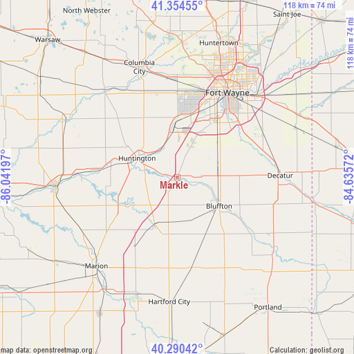
| Map corner | latitude | longitude |
|---|---|---|
| Upper-left | 41.35455°, | -86.04197° |
| Center: | 40.82462°, | -85.33884° |
| Lower-right: | 40.29042°, | -84.63572° |
| Map W x H: | 118.3×118.3 km | = 73.5×73.5mi |
| max Lat: | 71.29058° ⇑36.4% North |
| Markle: | 40.82462° |
| min Lat: | ⇓63.6% South 19.06759° |
| min Long | Markle | max Long |
| -171.73463° | -85.33884° | -66.98998° |
| W 55%⇐ | ⇒45% E |
Elevation
Elevation of Markle is 237 m = 778 ft, and this is 57.8 m = 190 ft below average elevation for this country.
| Max E: |
3189 m = 10463 ft | 40.6% |
| Avg. | 294.8 m = 967 ft | |
| Markle | 237 m = 778 ft | |
Min E: |
-60 m = -197 ft | 59.4% |
See also: United States elevation on elevation.city.
Geographical zone
Markle is located in North temperate zone (between Tropic of Cancer and the Arctic Circle). Distance of this Northern Tropic circle is 1933.4 km =1201.4 mi to South.| Distance of | km | miles | from Markle |
|---|---|---|---|
| North Pole | 5467.8 | 3397.5 | to North |
| Arctic Circle | 2861.9 | 1778.3 | to North |
| Tropic Cancer | 1933.4 | 1201.4 | to South |
| Equator | 4539.3 | 2820.6 | to South |


Nearby cities:
15 places around Markle: (largest is in red/bold)
• Andrews
22.5 km =14 mi,  280°
280°
• Berne
37.5 km =23.3 mi,  119°
119°
• Bluffton
17 km =10.6 mi, 124°
• Decatur
34.5 km =21.4 mi,  88°
88°
• Hoagland
32.2 km =20 mi,  64°
64°
• Huntington
14.8 km =9.2 mi,  295°
295°
• La Fontaine
36.3 km =22.6 mi,  242°
242°
• Monroe
35 km =21.7 mi,  104°
104°
• Montpelier
30.5 km =19 mi,  170°
170°
• Ossian
15.8 km =9.8 mi,  66°
66°
• Roanoke
15.6 km =9.7 mi,  349°
349°
• South Whitley
37.8 km =23.5 mi,  319°
319°
• Van Buren
27 km =16.8 mi,  211°
211°
• Warren
17.4 km =10.8 mi, 205°
• Zanesville
11.4 km =7.1 mi,  25°
25°
Sources, notices
• [Note1] Compared only with cities in United States existing in our database
• [Src1] Map data: © OpenStreetMap contributors (CC-BY-SA)
• [Src2] Other city data from geonames.org with taken over terms of usage.
• [Src3] Geographical zone / Annual Mean Temperature by Robert A. Rohde @ Wikipedia
