Beechwood geodata
Beechwood (Michigan) is a populated place; located in United States in America/Detroit (GMT-4) time zone. With population of 3,015 people, there are 9597 cities with bigger population in this country. Compared to other cities in United States, 81.9% of cities are located further ↓South; 52.5% of cities are located further ←West and 52.8% of cities have higher elevation than Beechwood. Note1
Administrative division(s):
- Level 1: Michigan
- Level 2: Ottawa County
- Level 3: Charter Township of Holland


Beechwood GPS coordinates[2]
42° 47' 49.092" North, 86° 7' 33.168" West
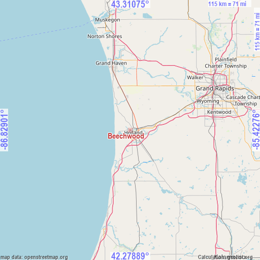
| Map corner | latitude | longitude |
|---|---|---|
| Upper-left | 43.31075°, | -86.82901° |
| Center: | 42.79697°, | -86.12588° |
| Lower-right: | 42.27889°, | -85.42276° |
| Map W x H: | 114.7×114.7 km | = 71.3×71.3mi |
| max Lat: | 71.29058° ⇑18.1% North |
| Beechwood: | 42.79697° |
| min Lat: | ⇓81.9% South 19.06759° |
| min Long | Beechwood | max Long |
| -171.73463° | -86.12588° | -66.98998° |
| W 52.5%⇐ | ⇒47.5% E |
Elevation
Elevation of Beechwood is 188 m = 617 ft, and this is 106.8 m = 350 ft below average elevation for this country.
| Max E: |
3189 m = 10463 ft | 52.8% |
| Avg. | 294.8 m = 967 ft | |
| Beechwood | 188 m = 617 ft | |
Min E: |
-60 m = -197 ft | 47.2% |
See also: United States elevation on elevation.city.
Geographical zone
Beechwood is located in North temperate zone (between Tropic of Cancer and the Arctic Circle). Distance of this Northern Tropic circle is 2152.7 km =1337.6 mi to South.| Distance of | km | miles | from Beechwood |
|---|---|---|---|
| North Pole | 5248.5 | 3261.3 | to North |
| Arctic Circle | 2642.6 | 1642 | to North |
| Tropic Cancer | 2152.7 | 1337.6 | to South |
| Equator | 4758.6 | 2956.9 | to South |


Nearby cities:
15 places around Beechwood: (largest is in red/bold)
• Allendale
24 km =14.9 mi,  35°
35°
• Byron Center
32.9 km =20.4 mi,  87°
87°
• Coopersville
33.5 km =20.8 mi,  27°
27°
• Douglas
18.1 km =11.2 mi,  199°
199°
• Fennville
22.7 km =14.1 mi,  174°
174°
• Ferrysburg
32.9 km =20.4 mi,  346°
346°
• Grand Haven
30.7 km =19.1 mi,  344°
344°
• Grandville
32.1 km =19.9 mi,  67°
67°
• Holland
1.7 km =1.1 mi,  127°
127°
• Hopkins
35.5 km =22.1 mi,  122°
122°
• Hudsonville
22.8 km =14.2 mi, 68°
• Jenison
29.9 km =18.6 mi, 65°
• Saugatuck
17 km =10.6 mi, 201°
• Spring Lake
31.7 km =19.7 mi, 349°
• Zeeland
8.9 km =5.5 mi,  78°
78°
Sources, notices
• [Note1] Compared only with cities in United States existing in our database
• [Src1] Map data: © OpenStreetMap contributors (CC-BY-SA)
• [Src2] Other city data from geonames.org with taken over terms of usage.
• [Src3] Geographical zone / Annual Mean Temperature by Robert A. Rohde @ Wikipedia
