Zeeland geodata
Zeeland (Michigan) is a populated place; located in United States in America/Detroit (GMT-4) time zone. With population of 5,626 people, there are 6659 cities with bigger population in this country. Compared to other cities in United States, 81.9% of cities are located further ↓South; 52.9% of cities are located further ←West and 50.2% of cities have lower elevation than Zeeland. Note1


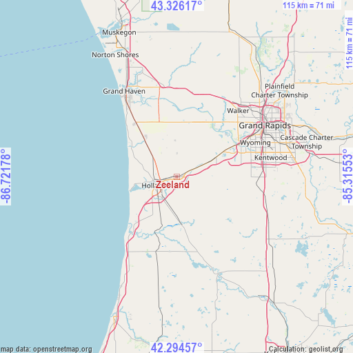
Zeeland GPS coordinates[2]
42° 48' 45.072" North, 86° 1' 7.14" West
| Map corner | latitude | longitude |
|---|---|---|
| Upper-left | 43.32617°, | -86.72178° |
| Center: | 42.81252°, | -86.01865° |
| Lower-right: | 42.29457°, | -85.31553° |
| Map W x H: | 114.7×114.7 km | = 71.3×71.3mi |
| max Lat: | 71.29058° ⇑18.1% North |
| Zeeland: | 42.81252° |
| min Lat: | ⇓81.9% South 19.06759° |
| min Long | Zeeland | max Long |
| -171.73463° | -86.01865° | -66.98998° |
| W 52.9%⇐ | ⇒47.1% E |
Elevation
Elevation of Zeeland is 199 m = 653 ft, and this is 95.8 m = 314 ft below average elevation for this country.
| Max E: |
3189 m = 10463 ft | 49.8% |
| Avg. | 294.8 m = 967 ft | |
| Zeeland | 199 m = 653 ft | |
Min E: |
-60 m = -197 ft | 50.2% |
See also: United States elevation on elevation.city.
Geographical zone
Zeeland is located in North temperate zone (between Tropic of Cancer and the Arctic Circle). Distance of this Northern Tropic circle is 2154.4 km =1338.7 mi to South.| Distance of | km | miles | from Zeeland |
|---|---|---|---|
| North Pole | 5246.8 | 3260.2 | to North |
| Arctic Circle | 2640.9 | 1641 | to North |
| Tropic Cancer | 2154.4 | 1338.7 | to South |
| Equator | 4760.3 | 2957.9 | to South |


Nearby cities:
15 places around Zeeland: (largest is in red/bold)
• Allendale
18.5 km =11.5 mi,  16°
16°
• Beechwood
8.9 km =5.5 mi,  258°
258°
• Byron Center
24.1 km =15 mi,  90°
90°
• Coopersville
28.8 km =17.9 mi,  13°
13°
• Cutlerville
29.1 km =18.1 mi,  83°
83°
• Douglas
24 km =14.9 mi,  218°
218°
• Fennville
25.2 km =15.7 mi,  195°
195°
• Grandville
23.5 km =14.6 mi,  62°
62°
• Holland
7.9 km =4.9 mi,  249°
249°
• Hopkins
29.8 km =18.5 mi,  134°
134°
• Hudsonville
14.1 km =8.8 mi, 62°
• Jenison
21.3 km =13.2 mi, 60°
• Saugatuck
23 km =14.3 mi, 220°
• Walker
29.3 km =18.2 mi,  44°
44°
• Wyoming
27.9 km =17.3 mi,  66°
66°
Sources, notices
• [Note1] Compared only with cities in United States existing in our database
• [Src1] Map data: © OpenStreetMap contributors (CC-BY-SA)
• [Src2] Other city data from geonames.org with taken over terms of usage.
• [Src3] Geographical zone / Annual Mean Temperature by Robert A. Rohde @ Wikipedia
