Parshall geodata
Parshall (North Dakota) is a populated place; located in United States in America/Chicago (GMT-5) time zone. With population of 1,263 people, there are 14772 cities with bigger population in this country. Compared to other cities in United States, 98.5% of cities are located further ↓South; 81.9% of cities are located further →East and 89.5% of cities have lower elevation than Parshall. Note1
Administrative division(s):
- Level 1: North Dakota
- Level 2: Mountrail County
- Level 3: City of Parshall


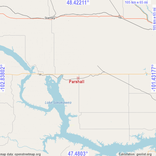
Parshall GPS coordinates[2]
47° 57' 12.06" North, 102° 8' 5.604" West
| Map corner | latitude | longitude |
|---|---|---|
| Upper-left | 48.42211°, | -102.83802° |
| Center: | 47.95335°, | -102.13489° |
| Lower-right: | 47.4803°, | -101.43177° |
| Map W x H: | 104.7×104.7 km | = 65.1×65.1mi |
| max Lat: | 71.29058° ⇑1.5% North |
| Parshall: | 47.95335° |
| min Lat: | ⇓98.5% South 19.06759° |
| min Long | Parshall | max Long |
| -171.73463° | -102.13489° | -66.98998° |
| W 18.1%⇐ | ⇒81.9% E |
Elevation
Elevation of Parshall is 589 m = 1932 ft, and this is 294.2 m = 965 ft above average elevation for this country.
| Max E: |
3189 m = 10463 ft | 10.5% |
| Parshall | 589 m 1932 ft | |
| Avg. | 294.8 m = 967 ft | |
Min E: |
-60 m = -197 ft | 89.5% |
See also: United States elevation on elevation.city.
Geographical zone
Parshall is located in North temperate zone (between Tropic of Cancer and the Arctic Circle). Distance of this North polar circle is 2069.3 km =1285.8 mi to North.| Distance of | km | miles | from Parshall |
|---|---|---|---|
| North Pole | 4675.1 | 2905 | to North |
| Arctic Circle | 2069.3 | 1285.8 | to North |
| Tropic Cancer | 2726 | 1693.9 | to South |
| Equator | 5331.9 | 3313.1 | to South |


Nearby cities:
15 places around Parshall: (largest is in red/bold)
• Berthold
49.7 km =30.9 mi,  36°
36°
• Beulah
81.3 km =50.5 mi,  160°
160°
• Burlington
63.5 km =39.5 mi,  55°
55°
• Four Bears Village
33.2 km =20.6 mi,  275°
275°
• Garrison
63.3 km =39.3 mi,  121°
121°
• Hazen
82.7 km =51.4 mi,  152°
152°
• Kenmare
80.3 km =49.9 mi,  2°
2°
• Killdeer
79.6 km =49.5 mi,  215°
215°
• Mandaree
47.5 km =29.5 mi,  238°
238°
• Minot
69.6 km =43.2 mi, 63°
• Minot Air Force Base
78.6 km =48.8 mi,  48°
48°
• New Town
26.6 km =16.5 mi, 276°
• Stanley
44.7 km =27.8 mi,  334°
334°
• Surrey
80.8 km =50.2 mi,  67°
67°
• Tioga
77.4 km =48.1 mi,  309°
309°
Sources, notices
• [Note1] Compared only with cities in United States existing in our database
• [Src1] Map data: © OpenStreetMap contributors (CC-BY-SA)
• [Src2] Other city data from geonames.org with taken over terms of usage.
• [Src3] Geographical zone / Annual Mean Temperature by Robert A. Rohde @ Wikipedia
