Owyhee geodata
Owyhee (Nevada) is a populated place; located in United States in America/Los_Angeles (GMT-7) time zone. With population of 953 people, there are 16616 cities with bigger population in this country. Compared to other cities in United States, 75.2% of cities are located further ↓South; 89.2% of cities are located further →East and 97.7% of cities have lower elevation than Owyhee. Note1


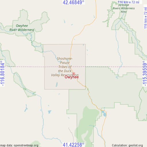
Owyhee GPS coordinates[2]
41° 56' 51.648" North, 116° 5' 55.356" West
| Map corner | latitude | longitude |
|---|---|---|
| Upper-left | 42.46849°, | -116.80184° |
| Center: | 41.94768°, | -116.09871° |
| Lower-right: | 41.42258°, | -115.39559° |
| Map W x H: | 116.3×116.3 km | = 72.3×72.3mi |
| max Lat: | 71.29058° ⇑24.8% North |
| Owyhee: | 41.94768° |
| min Lat: | ⇓75.2% South 19.06759° |
| min Long | Owyhee | max Long |
| -171.73463° | -116.09871° | -66.98998° |
| W 10.8%⇐ | ⇒89.2% E |
Elevation
Elevation of Owyhee is 1650 m = 5413 ft, and this is 1355.2 m = 4446 ft above average elevation for this country.
| Max E: |
3189 m = 10463 ft | 2.3% |
| Owyhee | 1650 m 5413 ft | |
| Avg. | 294.8 m = 967 ft | |
Min E: |
-60 m = -197 ft | 97.7% |
See also: United States elevation on elevation.city.
Geographical zone
Owyhee is located in North temperate zone (between Tropic of Cancer and the Arctic Circle). Distance of this Northern Tropic circle is 2058.2 km =1278.9 mi to South.| Distance of | km | miles | from Owyhee |
|---|---|---|---|
| North Pole | 5342.9 | 3319.9 | to North |
| Arctic Circle | 2737 | 1700.7 | to North |
| Tropic Cancer | 2058.2 | 1278.9 | to South |
| Equator | 4664.1 | 2898.1 | to South |


Nearby cities:
15 places around Owyhee: (largest is in red/bold)
• Buhl
131.9 km =82 mi,  56°
56°
• Carlin
137.2 km =85.3 mi,  180°
180°
• Elko
127.1 km =79 mi,  167°
167°
• Filer
140.9 km =87.6 mi, 60°
• Glenns Ferry
129.7 km =80.6 mi,  30°
30°
• Hagerman
137.7 km =85.6 mi,  45°
45°
• Jackpot
117.8 km =73.2 mi,  88°
88°
• Jerome
155.9 km =96.9 mi, 56°
• Mountain Home
136 km =84.5 mi,  14°
14°
• Murphy
146.1 km =90.8 mi,  345°
345°
• Osino
118.7 km =73.8 mi,  162°
162°
• Spring Creek
142.4 km =88.5 mi, 162°
• Twin Falls
151.2 km =94 mi, 63°
• Wells
132.5 km =82.3 mi,  134°
134°
• Wendell
147 km =91.3 mi, 51°
Sources, notices
• [Note1] Compared only with cities in United States existing in our database
• [Src1] Map data: © OpenStreetMap contributors (CC-BY-SA)
• [Src2] Other city data from geonames.org with taken over terms of usage.
• [Src3] Geographical zone / Annual Mean Temperature by Robert A. Rohde @ Wikipedia
