Elko geodata
Elko (Nevada) is a seat of a second-order administrative division; located in United States in America/Los_Angeles (GMT-7) time zone. With population of 20,279 people, there are 2479 cities with bigger population in this country. Compared to other cities in United States, 63.7% of cities are located further ↓South; 89.1% of cities are located further →East and 97.1% of cities have lower elevation than Elko. Note1


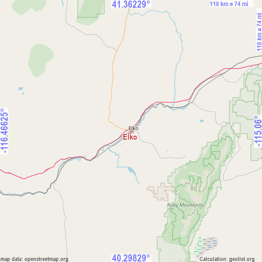
Elko GPS coordinates[2]
40° 49' 56.712" North, 115° 45' 47.232" West
| Map corner | latitude | longitude |
|---|---|---|
| Upper-left | 41.36229°, | -116.46625° |
| Center: | 40.83242°, | -115.76312° |
| Lower-right: | 40.29829°, | -115.06° |
| Map W x H: | 118.3×118.3 km | = 73.5×73.5mi |
| max Lat: | 71.29058° ⇑36.3% North |
| Elko: | 40.83242° |
| min Lat: | ⇓63.7% South 19.06759° |
| min Long | Elko | max Long |
| -171.73463° | -115.76312° | -66.98998° |
| W 10.9%⇐ | ⇒89.1% E |
Elevation
Elevation of Elko is 1551 m = 5089 ft, and this is 1256.2 m = 4121 ft above average elevation for this country.
| Max E: |
3189 m = 10463 ft | 2.9% |
| Elko | 1551 m 5089 ft | |
| Avg. | 294.8 m = 967 ft | |
Min E: |
-60 m = -197 ft | 97.1% |
See also: United States elevation on elevation.city.
Geographical zone
Elko is located in North temperate zone (between Tropic of Cancer and the Arctic Circle). Distance of this Northern Tropic circle is 1934.2 km =1201.9 mi to South.| Distance of | km | miles | from Elko |
|---|---|---|---|
| North Pole | 5466.9 | 3397 | to North |
| Arctic Circle | 2861 | 1777.7 | to North |
| Tropic Cancer | 1934.2 | 1201.9 | to South |
| Equator | 4540.1 | 2821.1 | to South |


Nearby cities:
15 places around Elko: (largest is in red/bold)
• Battle Mountain
100.9 km =62.7 mi,  257°
257°
• Buhl
213.4 km =132.6 mi,  22°
22°
• Carlin
31.6 km =19.6 mi,  245°
245°
• Ely
191.3 km =118.9 mi,  157°
157°
• Eureka
147.7 km =91.8 mi,  186°
186°
• Filer
215.7 km =134 mi,  26°
26°
• Jackpot
156.9 km =97.5 mi,  35°
35°
• McGill
179.4 km =111.5 mi,  152°
152°
• Osino
14 km =8.7 mi, 37°
• Owyhee
127.1 km =79 mi,  347°
347°
• Spring Creek
19 km =11.8 mi,  128°
128°
• Wells
73.9 km =45.9 mi,  65°
65°
• Wendover
145.7 km =90.5 mi,  94°
94°
• West Wendover
142.6 km =88.6 mi, 94°
• Winnemucca
166.5 km =103.5 mi,  275°
275°
Sources, notices
• [Note1] Compared only with cities in United States existing in our database
• [Src1] Map data: © OpenStreetMap contributors (CC-BY-SA)
• [Src2] Other city data from geonames.org with taken over terms of usage.
• [Src3] Geographical zone / Annual Mean Temperature by Robert A. Rohde @ Wikipedia
