Osino geodata
Osino (Nevada) is a populated place; located in United States in America/Los_Angeles (GMT-7) time zone. With population of 709 people, there are 18587 cities with bigger population in this country. Compared to other cities in United States, 65.1% of cities are located further ↓South; 89.1% of cities are located further →East and 97.2% of cities have lower elevation than Osino. Note1


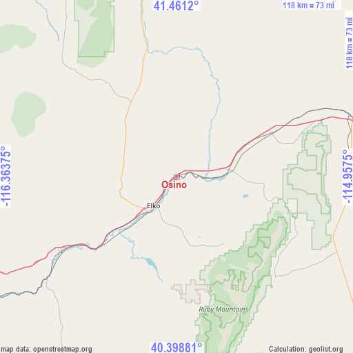
Osino GPS coordinates[2]
40° 55' 55.704" North, 115° 39' 38.232" West
| Map corner | latitude | longitude |
|---|---|---|
| Upper-left | 41.4612°, | -116.36375° |
| Center: | 40.93214°, | -115.66062° |
| Lower-right: | 40.39881°, | -114.9575° |
| Map W x H: | 118.1×118.1 km | = 73.4×73.4mi |
| max Lat: | 71.29058° ⇑34.9% North |
| Osino: | 40.93214° |
| min Lat: | ⇓65.1% South 19.06759° |
| min Long | Osino | max Long |
| -171.73463° | -115.66062° | -66.98998° |
| W 10.9%⇐ | ⇒89.1% E |
Elevation
Elevation of Osino is 1569 m = 5148 ft, and this is 1274.2 m = 4180 ft above average elevation for this country.
| Max E: |
3189 m = 10463 ft | 2.8% |
| Osino | 1569 m 5148 ft | |
| Avg. | 294.8 m = 967 ft | |
Min E: |
-60 m = -197 ft | 97.2% |
See also: United States elevation on elevation.city.
Geographical zone
Osino is located in North temperate zone (between Tropic of Cancer and the Arctic Circle). Distance of this Northern Tropic circle is 1945.3 km =1208.8 mi to South.| Distance of | km | miles | from Osino |
|---|---|---|---|
| North Pole | 5455.8 | 3390.1 | to North |
| Arctic Circle | 2849.9 | 1770.8 | to North |
| Tropic Cancer | 1945.3 | 1208.8 | to South |
| Equator | 4551.2 | 2828 | to South |


Nearby cities:
15 places around Osino: (largest is in red/bold)
• Battle Mountain
112 km =69.6 mi,  253°
253°
• Buhl
199.8 km =124.1 mi,  21°
21°
• Carlin
44.5 km =27.7 mi,  236°
236°
• Elko
14 km =8.7 mi,  217°
217°
• Ely
198.5 km =123.3 mi,  160°
160°
• Eureka
159.9 km =99.4 mi,  189°
189°
• Filer
202 km =125.5 mi,  25°
25°
• Jackpot
142.9 km =88.8 mi,  35°
35°
• McGill
185.6 km =115.3 mi, 156°
• Owyhee
118.7 km =73.8 mi,  342°
342°
• Spring Creek
23.7 km =14.7 mi, 164°
• Wells
61.7 km =38.3 mi,  71°
71°
• Wendover
138.3 km =85.9 mi,  99°
99°
• West Wendover
135.2 km =84 mi, 99°
• Winnemucca
174.3 km =108.3 mi,  271°
271°
Sources, notices
• [Note1] Compared only with cities in United States existing in our database
• [Src1] Map data: © OpenStreetMap contributors (CC-BY-SA)
• [Src2] Other city data from geonames.org with taken over terms of usage.
• [Src3] Geographical zone / Annual Mean Temperature by Robert A. Rohde @ Wikipedia
