Spring Creek geodata
Spring Creek (Nevada) is a populated place; located in United States in America/Los_Angeles (GMT-7) time zone. With population of 12,361 people, there are 3803 cities with bigger population in this country. Compared to other cities in United States, 62% of cities are located further ↓South; 89% of cities are located further →East and 98% of cities have lower elevation than Spring Creek. Note1


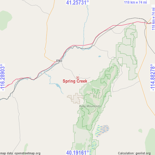
Spring Creek GPS coordinates[2]
40° 43' 35.724" North, 115° 35' 9.24" West
| Map corner | latitude | longitude |
|---|---|---|
| Upper-left | 41.25731°, | -116.28903° |
| Center: | 40.72659°, | -115.5859° |
| Lower-right: | 40.19161°, | -114.88278° |
| Map W x H: | 118.5×118.5 km | = 73.6×73.6mi |
| max Lat: | 71.29058° ⇑38% North |
| Spring Creek: | 40.72659° |
| min Lat: | ⇓62% South 19.06759° |
| min Long | Spring Creek | max Long |
| -171.73463° | -115.5859° | -66.98998° |
| W 11%⇐ | ⇒89% E |
Elevation
Elevation of Spring Creek is 1725 m = 5659 ft, and this is 1430.2 m = 4692 ft above average elevation for this country.
| Max E: |
3189 m = 10463 ft | 2% |
| Spring Creek | 1725 m 5659 ft | |
| Avg. | 294.8 m = 967 ft | |
Min E: |
-60 m = -197 ft | 98% |
See also: United States elevation on elevation.city.
Geographical zone
Spring Creek is located in North temperate zone (between Tropic of Cancer and the Arctic Circle). Distance of this Northern Tropic circle is 1922.5 km =1194.6 mi to South.| Distance of | km | miles | from Spring Creek |
|---|---|---|---|
| North Pole | 5478.7 | 3404.3 | to North |
| Arctic Circle | 2872.8 | 1785.1 | to North |
| Tropic Cancer | 1922.5 | 1194.6 | to South |
| Equator | 4528.4 | 2813.8 | to South |


Nearby cities:
15 places around Spring Creek: (largest is in red/bold)
• Battle Mountain
114.1 km =70.9 mi,  265°
265°
• Buhl
219.2 km =136.2 mi,  18°
18°
• Carlin
43.7 km =27.2 mi, 268°
• Elko
19 km =11.8 mi,  308°
308°
• Ely
174.9 km =108.7 mi,  160°
160°
• Eureka
138.7 km =86.2 mi,  193°
193°
• Jackpot
159.1 km =98.9 mi,  28°
28°
• McGill
162.2 km =100.8 mi,  154°
154°
• Oakley
220.4 km =137 mi,  40°
40°
• Osino
23.7 km =14.7 mi,  344°
344°
• Owyhee
142.4 km =88.5 mi, 342°
• Wells
67.5 km =41.9 mi,  50°
50°
• Wendover
130.5 km =81.1 mi,  89°
89°
• West Wendover
127.4 km =79.2 mi, 89°
• Winnemucca
182.9 km =113.6 mi,  278°
278°
Sources, notices
• [Note1] Compared only with cities in United States existing in our database
• [Src1] Map data: © OpenStreetMap contributors (CC-BY-SA)
• [Src2] Other city data from geonames.org with taken over terms of usage.
• [Src3] Geographical zone / Annual Mean Temperature by Robert A. Rohde @ Wikipedia
