Avenue B and C geodata
Avenue B and C (Arizona) is a populated place; located in United States in America/Phoenix (GMT-7) time zone. With population of 4,176 people, there are 8020 cities with bigger population in this country. Compared to other cities in United States, 86.3% of cities are located further ↑North; 88.8% of cities are located further →East and 81.1% of cities have higher elevation than Avenue B and C. Note1


Avenue B and C GPS coordinates[2]
32° 43' 8.544" North, 114° 39' 36.18" West
| Map corner | latitude | longitude |
|---|---|---|
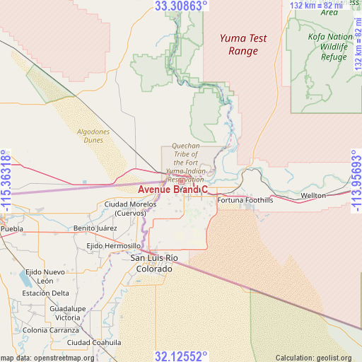
| Upper-left | 33.30863°, | -115.36318° |
| Center: | 32.71904°, | -114.66005° |
| Lower-right: | 32.12552°, | -113.95693° |
| Map W x H: | 131.5×131.5 km | = 81.7×81.7mi |
| max Lat: | 71.29058° ⇑86.3% North |
| Avenue B and C: | 32.71904° |
| min Lat: | ⇓13.7% South 19.06759° |
| min Long | Avenue B and C | max Long |
| -171.73463° | -114.66005° | -66.98998° |
| W 11.2%⇐ | ⇒88.8% E |
Elevation
Elevation of Avenue B and C is 42 m = 138 ft, and this is 252.8 m = 829 ft below average elevation for this country.
| Max E: |
3189 m = 10463 ft | 81.1% |
| Avg. | 294.8 m = 967 ft | |
| Avenue B and C | 42 m = 138 ft | |
Min E: |
-60 m = -197 ft | 18.9% |
See also: United States elevation on elevation.city.
Geographical zone
Avenue B and C is located in North temperate zone (between Tropic of Cancer and the Arctic Circle). Distance of this Northern Tropic circle is 1032.1 km =641.3 mi to South.| Distance of | km | miles | from Avenue B and C |
|---|---|---|---|
| North Pole | 6369 | 3957.5 | to North |
| Arctic Circle | 3763.2 | 2338.3 | to North |
| Tropic Cancer | 1032.1 | 641.3 | to South |
| Equator | 3638 | 2260.5 | to South |


Nearby cities:
15 places around Avenue B and C: (largest is in red/bold)
• Calexico
78.6 km =48.8 mi,  266°
266°
• Donovan Estates
2 km =1.2 mi,  237°
237°
• El Centro
84.8 km =52.7 mi,  275°
275°
• El Prado Estates
13 km =8.1 mi,  96°
96°
• Fortuna Foothills
24.2 km =15 mi,  106°
106°
• Gadsden
21.7 km =13.5 mi,  212°
212°
• Heber
81.4 km =50.6 mi, 270°
• Holtville
68.1 km =42.3 mi, 278°
• Orange Grove Mobile Manor
13.4 km =8.3 mi,  180°
180°
• Rancho Mesa Verde
13.9 km =8.6 mi, 178°
• San Luis
28.2 km =17.5 mi,  203°
203°
• Somerton
14.4 km =8.9 mi, 198°
• Tacna
66.1 km =41.1 mi,  92°
92°
• Wellton
48.3 km =30 mi, 96°
• Yuma
3.4 km =2.1 mi,  78°
78°
Sources, notices
• [Note1] Compared only with cities in United States existing in our database
• [Src1] Map data: © OpenStreetMap contributors (CC-BY-SA)
• [Src2] Other city data from geonames.org with taken over terms of usage.
• [Src3] Geographical zone / Annual Mean Temperature by Robert A. Rohde @ Wikipedia
