Artigas geodata
Artigas is a seat of a first-order administrative division; located in Uruguay in America/Montevideo (GMT-3) time zone. With population of 41,909 people, there are 9 cities with bigger population in this country. Compared to other cities in Uruguay, 98.4% of cities are located further ↓South; 63.9% of cities are located further →East and 79.5% of cities have lower elevation than Artigas. Note1


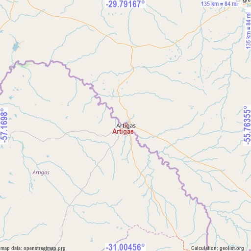
Artigas GPS coordinates[2]
30° 24' 0" South, 56° 28' 0.012" West
| Map corner | latitude | longitude |
|---|---|---|
| Upper-left | -29.79167°, | -57.1698° |
| Center: | -30.4°, | -56.46667° |
| Lower-right: | -31.00456°, | -55.76355° |
| Map W x H: | 134.9×134.9 km | = 83.8×83.8mi |
| max Lat: | -30.25966° ⇑1.6% North |
| Artigas: | -30.4° |
| min Lat: | ⇓98.4% South -34.94747° |
| min Long | Artigas | max Long |
| -58.41176° | -56.46667° | -53.38583° |
| W 36.1%⇐ | ⇒63.9% E |
Elevation
Elevation of Artigas is 113 m = 371 ft, and this is 42.4 m = 139 ft above average elevation for this country.
| Max E: |
294 m = 965 ft | 20.5% |
| Artigas | 113 m 371 ft | |
| Avg. | 70.6 m = 232 ft | |
Min E: |
2 m = 7 ft | 79.5% |
See also: Artigas elevation on elevation.city.
Geographical zone
Artigas is located in South temperate zone (between Tropic of Capricorn and the Antarctic Circle). Distance of this Southern Tropic circle is 774.2 km =481.1 mi to North.| Distance of | km | miles | from Artigas |
|---|---|---|---|
| Equator | 3380.2 | 2100.4 | to North |
| Tropic Capricorn | 774.2 | 481.1 | to North |
| Antarctic Circle | 4021 | 2498.5 | to South |
| South Pole | 6626.9 | 4117.8 | to South |


Nearby cities:
15 places around Artigas: (largest is in red/bold)
• Baltasar Brum
89.6 km =55.7 mi,  246°
246°
• Bella Unión
109.8 km =68.2 mi,  278°
278°
• Belén
132.5 km =82.3 mi, 251°
• Curtina
197.4 km =122.7 mi,  170°
170°
• Guichón
228.6 km =142 mi,  197°
197°
• Las Piedras
108.1 km =67.2 mi, 278°
• Minas de Corrales
161.4 km =100.3 mi,  143°
143°
• Quebracho
218.6 km =135.8 mi,  218°
218°
• Rivera
104.1 km =64.7 mi,  122°
122°
• Salto
180.1 km =111.9 mi,  232°
232°
• Tacuarembó
153.6 km =95.4 mi,  162°
162°
• Tomás Gomensoro
93 km =57.8 mi,  268°
268°
• Tranqueras
112.2 km =69.7 mi, 142°
• Vichadero
228.1 km =141.7 mi,  132°
132°
• Villa Constitución
151.7 km =94.3 mi,  240°
240°
Sources, notices
• [Note1] Compared only with cities in Uruguay existing in our database
• [Src1] Map data: © OpenStreetMap contributors (CC-BY-SA)
• [Src2] Other city data from geonames.org with taken over terms of usage.
• [Src3] Geographical zone / Annual Mean Temperature by Robert A. Rohde @ Wikipedia
