Quebracho geodata
Quebracho (Paysandú) is a populated place; located in Uruguay in America/Montevideo (GMT-3) time zone. With population of 2,871 people, there are 70 cities with bigger population in this country. Compared to other cities in Uruguay, 88.5% of cities are located further ↓South; 91% of cities are located further →East and 60.7% of cities have lower elevation than Quebracho. Note1


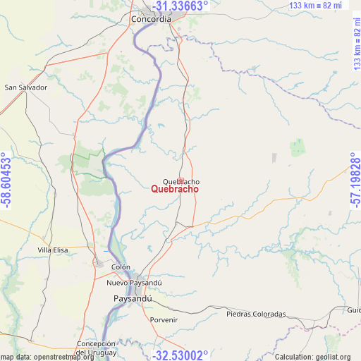
Quebracho GPS coordinates[2]
31° 56' 6.936" South, 57° 54' 5.04" West
| Map corner | latitude | longitude |
|---|---|---|
| Upper-left | -31.33663°, | -58.60453° |
| Center: | -31.93526°, | -57.9014° |
| Lower-right: | -32.53002°, | -57.19828° |
| Map W x H: | 132.7×132.7 km | = 82.5×82.5mi |
| max Lat: | -30.25966° ⇑11.5% North |
| Quebracho: | -31.93526° |
| min Lat: | ⇓88.5% South -34.94747° |
| min Long | Quebracho | max Long |
| -58.41176° | -57.9014° | -53.38583° |
| W 9%⇐ | ⇒91% E |
Elevation
Elevation of Quebracho is 66 m = 217 ft, and this is 4.6 m = 15 ft below average elevation for this country.
| Max E: |
294 m = 965 ft | 39.3% |
| Avg. | 70.6 m = 232 ft | |
| Quebracho | 66 m = 217 ft | |
Min E: |
2 m = 7 ft | 60.7% |
See also: Uruguay elevation on elevation.city.
Geographical zone
Quebracho is located in South temperate zone (between Tropic of Capricorn and the Antarctic Circle). Distance of this Southern Tropic circle is 944.9 km =587.1 mi to North.| Distance of | km | miles | from Quebracho |
|---|---|---|---|
| Equator | 3550.9 | 2206.4 | to North |
| Tropic Capricorn | 944.9 | 587.1 | to North |
| Antarctic Circle | 3850.3 | 2392.5 | to South |
| South Pole | 6456.2 | 4011.7 | to South |


Nearby cities:
15 places around Quebracho: (largest is in red/bold)
• Baltasar Brum
145.9 km =90.7 mi,  22°
22°
• Belén
128.2 km =79.7 mi,  5°
5°
• Estación Porvenir
48.6 km =30.2 mi,  174°
174°
• Fray Bentos
136.8 km =85 mi,  196°
196°
• Guichón
81.3 km =50.5 mi,  125°
125°
• Mercedes
147 km =91.3 mi,  184°
184°
• Nuevo Berlín
117.1 km =72.8 mi,  187°
187°
• Paso de los Toros
162.8 km =101.2 mi, 127°
• Paysandú
45.7 km =28.4 mi, 201°
• Piedras Coloradas
55.8 km =34.7 mi,  150°
150°
• Salto
61.7 km =38.3 mi,  354°
354°
• San Félix
49.4 km =30.7 mi, 202°
• San Javier
84 km =52.2 mi, 195°
• Villa Constitución
96.4 km =59.9 mi,  2°
2°
• Young
88.7 km =55.1 mi,  163°
163°
Sources, notices
• [Note1] Compared only with cities in Uruguay existing in our database
• [Src1] Map data: © OpenStreetMap contributors (CC-BY-SA)
• [Src2] Other city data from geonames.org with taken over terms of usage.
• [Src3] Geographical zone / Annual Mean Temperature by Robert A. Rohde @ Wikipedia
