Konimex geodata
Konimex (Navoiy) is a seat of a second-order administrative division; located in Uzbekistan in Asia/Samarkand (GMT+5) time zone. In our database, there are 114 cities with bigger population. Compared to other cities in Uzbekistan, 62.6% of cities are located further ↑North; 74.1% of cities are located further →East and 66.1% of cities have higher elevation than Konimex. Note1


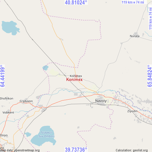
Konimex GPS coordinates[2]
40° 16' 33.348" North, 65° 8' 42.396" East
| Map corner | latitude | longitude |
|---|---|---|
| Upper-left | 40.81024°, | 64.44199° |
| Center: | 40.27593°, | 65.14511° |
| Lower-right: | 39.73736°, | 65.84824° |
| Map W x H: | 119.3×119.3 km | = 74.1×74.1mi |
| max Lat: | 43.77877° ⇑62.6% North |
| Konimex: | 40.27593° |
| min Lat: | ⇓37.4% South 37.22417° |
| min Long | Konimex | max Long |
| 58.84596° | 65.14511° | 72.76177° |
| W 25.9%⇐ | ⇒74.1% E |
Elevation
Elevation of Konimex is 323 m = 1060 ft, and this is 110.8 m = 364 ft below average elevation for this country.
| Max E: |
1464 m = 4803 ft | 66.1% |
| Avg. | 433.8 m = 1423 ft | |
| Konimex | 323 m = 1060 ft | |
Min E: |
50 m = 164 ft | 33.9% |
See also: Uzbekistan elevation on elevation.city.
Geographical zone
Konimex is located in North temperate zone (between Tropic of Cancer and the Arctic Circle). Distance of this Northern Tropic circle is 1872.3 km =1163.4 mi to South.| Distance of | km | miles | from Konimex |
|---|---|---|---|
| North Pole | 5528.8 | 3435.4 | to North |
| Arctic Circle | 2922.9 | 1816.2 | to North |
| Tropic Cancer | 1872.3 | 1163.4 | to South |
| Equator | 4478.3 | 2782.7 | to South |


Nearby cities:
15 places around Konimex: (largest is in red/bold)
• Beshrabot
18.3 km =11.4 mi,  118°
118°
• Galaosiyo
75.3 km =46.8 mi,  231°
231°
• Ghijduwon
43.8 km =27.2 mi,  243°
243°
• Karmana Shahri
24.9 km =15.5 mi,  128°
128°
• Kogon
79.6 km =49.5 mi,  219°
219°
• Navoiy
29.1 km =18.1 mi,  136°
136°
• Nurota
55.9 km =34.7 mi,  55°
55°
• Nurota Shahri
55.7 km =34.6 mi,  54°
54°
• Oqtosh
77.2 km =48 mi, 120°
• Qiziltepa
36.9 km =22.9 mi, 222°
• Qiziltepa Shahri
38.7 km =24 mi, 223°
• Romiton
75.7 km =47 mi, 239°
• Shofirkon
57.4 km =35.7 mi,  252°
252°
• Wobkent
60.1 km =37.3 mi, 242°
• Yangirabot
74.7 km =46.4 mi,  111°
111°
Sources, notices
• [Note1] Compared only with cities in Uzbekistan existing in our database
• [Src1] Map data: © OpenStreetMap contributors (CC-BY-SA)
• [Src2] Other city data from geonames.org with taken over terms of usage.
• [Src3] Geographical zone / Annual Mean Temperature by Robert A. Rohde @ Wikipedia
