G‘uzor Shahri geodata
G‘uzor Shahri (Qashqadaryo) is a seat of a second-order administrative division; located in Uzbekistan in Asia/Samarkand (GMT+5) time zone. In our database, there are 114 cities with bigger population. Compared to other cities in Uzbekistan, 96.6% of cities are located further ↑North; 62.6% of cities are located further →East and 69.5% of cities have lower elevation than G‘uzor Shahri. Note1


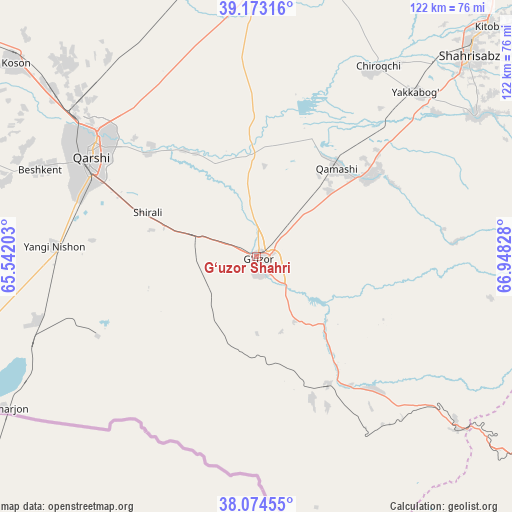
G‘uzor Shahri GPS coordinates[2]
38° 37' 33.456" North, 66° 14' 42.54" East
| Map corner | latitude | longitude |
|---|---|---|
| Upper-left | 39.17316°, | 65.54203° |
| Center: | 38.62596°, | 66.24515° |
| Lower-right: | 38.07455°, | 66.94828° |
| Map W x H: | 122.2×122.2 km | = 75.9×75.9mi |
| max Lat: | 43.77877° ⇑96.6% North |
| G‘uzor Shahri: | 38.62596° |
| min Lat: | ⇓3.4% South 37.22417° |
| min Long | G‘uzor Shahri | max Long |
| 58.84596° | 66.24515° | 72.76177° |
| W 37.4%⇐ | ⇒62.6% E |
Elevation
Elevation of G‘uzor Shahri is 517 m = 1696 ft, and this is 83.2 m = 273 ft above average elevation for this country.
| Max E: |
1464 m = 4803 ft | 30.5% |
| G‘uzor Shahri | 517 m 1696 ft | |
| Avg. | 433.8 m = 1423 ft | |
Min E: |
50 m = 164 ft | 69.5% |
See also: Uzbekistan elevation on elevation.city.
Geographical zone
G‘uzor Shahri is located in North temperate zone (between Tropic of Cancer and the Arctic Circle). Distance of this Northern Tropic circle is 1688.9 km =1049.4 mi to South.| Distance of | km | miles | from G‘uzor Shahri |
|---|---|---|---|
| North Pole | 5712.3 | 3549.5 | to North |
| Arctic Circle | 3106.4 | 1930.2 | to North |
| Tropic Cancer | 1688.9 | 1049.4 | to South |
| Equator | 4294.8 | 2668.7 | to South |


Nearby cities:
15 places around G‘uzor Shahri: (largest is in red/bold)
• Beshkent
55.8 km =34.7 mi,  292°
292°
• Beshkent Shahri
56.2 km =34.9 mi, 291°
• Chiroqchi
53.5 km =33.2 mi,  32°
32°
• Chiroqchi Shahri
53.3 km =33.1 mi, 33°
• G‘uzor
0.6 km =0.4 mi,  156°
156°
• Kitob
72 km =44.7 mi,  44°
44°
• Koson
73.2 km =45.5 mi,  308°
308°
• Nishon Tumani
50.1 km =31.1 mi,  278°
278°
• Qamashi Shahri
28.8 km =17.9 mi, 41°
• Qarshi
47.4 km =29.5 mi,  303°
303°
• Qorashina
42 km =26.1 mi,  138°
138°
• Shahrisabz
70.1 km =43.6 mi,  46°
46°
• Shahrisabz Shahri
68.8 km =42.8 mi, 46°
• Yakkabog‘ Shahri
54.7 km =34 mi, 44°
• Yangi-Nishon Shahri
48.3 km =30 mi,  272°
272°
Sources, notices
• [Note1] Compared only with cities in Uzbekistan existing in our database
• [Src1] Map data: © OpenStreetMap contributors (CC-BY-SA)
• [Src2] Other city data from geonames.org with taken over terms of usage.
• [Src3] Geographical zone / Annual Mean Temperature by Robert A. Rohde @ Wikipedia
