Payshanba geodata
Payshanba (Samarqand) is a populated place; located in Uzbekistan in Asia/Samarkand (GMT+5) time zone. With population of 24,772 people, there are 73 cities with bigger population in this country. Compared to other cities in Uzbekistan, 71.8% of cities are located further ↑North; 63.2% of cities are located further →East and 60.9% of cities have lower elevation than Payshanba. Note1


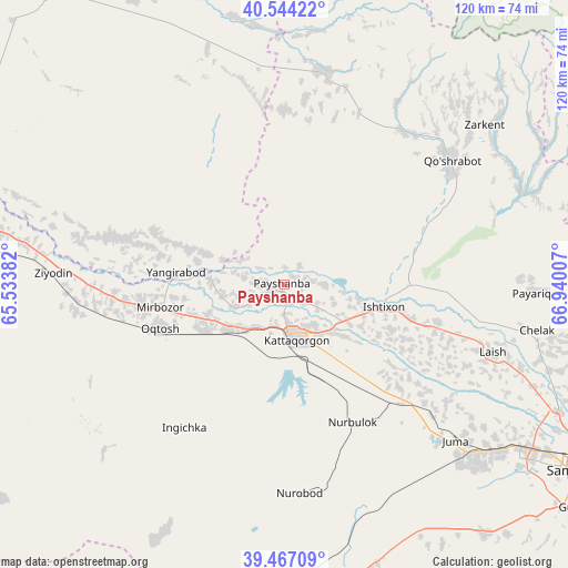
Payshanba GPS coordinates[2]
40° 0' 28.008" North, 66° 14' 12.984" East
| Map corner | latitude | longitude |
|---|---|---|
| Upper-left | 40.54422°, | 65.53382° |
| Center: | 40.00778°, | 66.23694° |
| Lower-right: | 39.46709°, | 66.94007° |
| Map W x H: | 119.8×119.8 km | = 74.4×74.4mi |
| max Lat: | 43.77877° ⇑71.8% North |
| Payshanba: | 40.00778° |
| min Lat: | ⇓28.2% South 37.22417° |
| min Long | Payshanba | max Long |
| 58.84596° | 66.23694° | 72.76177° |
| W 36.8%⇐ | ⇒63.2% E |
Elevation
Elevation of Payshanba is 468 m = 1535 ft, and this is 34.2 m = 112 ft above average elevation for this country.
| Max E: |
1464 m = 4803 ft | 39.1% |
| Payshanba | 468 m 1535 ft | |
| Avg. | 433.8 m = 1423 ft | |
Min E: |
50 m = 164 ft | 60.9% |
See also: Uzbekistan elevation on elevation.city.
Geographical zone
Payshanba is located in North temperate zone (between Tropic of Cancer and the Arctic Circle). Distance of this Northern Tropic circle is 1842.5 km =1144.9 mi to South.| Distance of | km | miles | from Payshanba |
|---|---|---|---|
| North Pole | 5558.6 | 3454 | to North |
| Arctic Circle | 2952.7 | 1834.7 | to North |
| Tropic Cancer | 1842.5 | 1144.9 | to South |
| Equator | 4448.4 | 2764.1 | to South |


Nearby cities:
15 places around Payshanba: (largest is in red/bold)
• Beshrabot
79.5 km =49.4 mi,  285°
285°
• Charxin
57.1 km =35.5 mi,  127°
127°
• Chelak
54.1 km =33.6 mi,  100°
100°
• Daxbet
63.7 km =39.6 mi,  115°
115°
• Ishtixon
21.7 km =13.5 mi, 102°
• Jomboy
80.8 km =50.2 mi, 115°
• Juma
48.8 km =30.3 mi, 131°
• Karmana Shahri
74.7 km =46.4 mi,  281°
281°
• Kattaqo‘rg‘on
12.2 km =7.6 mi,  172°
172°
• Navoiy
73.5 km =45.7 mi, 276°
• Nurota
77.2 km =48 mi,  322°
322°
• Nurota Shahri
78.2 km =48.6 mi, 322°
• Oqtosh
28.2 km =17.5 mi,  250°
250°
• Samarkand
73.2 km =45.5 mi, 122°
• Yangirabot
23.6 km =14.7 mi,  274°
274°
Sources, notices
• [Note1] Compared only with cities in Uzbekistan existing in our database
• [Src1] Map data: © OpenStreetMap contributors (CC-BY-SA)
• [Src2] Other city data from geonames.org with taken over terms of usage.
• [Src3] Geographical zone / Annual Mean Temperature by Robert A. Rohde @ Wikipedia
