Nurota geodata
Nurota (Navoiy) is a populated place; located in Uzbekistan in Asia/Samarkand (GMT+5) time zone. With population of 29,403 people, there are 46 cities with bigger population in this country. Compared to other cities in Uzbekistan, 51.1% of cities are located further ↓South; 66.1% of cities are located further →East and 63.8% of cities have lower elevation than Nurota. Note1


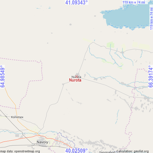
Nurota GPS coordinates[2]
40° 33' 41.004" North, 65° 41' 18.996" East
| Map corner | latitude | longitude |
|---|---|---|
| Upper-left | 41.09343°, | 64.98549° |
| Center: | 40.56139°, | 65.68861° |
| Lower-right: | 40.02509°, | 66.39174° |
| Map W x H: | 118.8×118.8 km | = 73.8×73.8mi |
| max Lat: | 43.77877° ⇑48.9% North |
| Nurota: | 40.56139° |
| min Lat: | ⇓51.1% South 37.22417° |
| min Long | Nurota | max Long |
| 58.84596° | 65.68861° | 72.76177° |
| W 33.9%⇐ | ⇒66.1% E |
Elevation
Elevation of Nurota is 493 m = 1617 ft, and this is 59.2 m = 194 ft above average elevation for this country.
| Max E: |
1464 m = 4803 ft | 36.2% |
| Nurota | 493 m 1617 ft | |
| Avg. | 433.8 m = 1423 ft | |
Min E: |
50 m = 164 ft | 63.8% |
See also: Uzbekistan elevation on elevation.city.
Geographical zone
Nurota is located in North temperate zone (between Tropic of Cancer and the Arctic Circle). Distance of this Northern Tropic circle is 1904.1 km =1183.2 mi to South.| Distance of | km | miles | from Nurota |
|---|---|---|---|
| North Pole | 5497.1 | 3415.7 | to North |
| Arctic Circle | 2891.2 | 1796.5 | to North |
| Tropic Cancer | 1904.1 | 1183.2 | to South |
| Equator | 4510 | 2802.4 | to South |


Nearby cities:
15 places around Nurota: (largest is in red/bold)
• Beshrabot
50.3 km =31.3 mi,  216°
216°
• Ghijduwon
99.5 km =61.8 mi,  238°
238°
• Ishtixon
94.6 km =58.8 mi,  134°
134°
• Karmana Shahri
54.1 km =33.6 mi,  209°
209°
• Kattaqo‘rg‘on
88 km =54.7 mi,  146°
146°
• Konimex
55.9 km =34.7 mi, 235°
• Navoiy
59.2 km =36.8 mi, 206°
• Nurota Shahri
1 km =0.6 mi,  311°
311°
• Oqtosh
73.9 km =45.9 mi,  164°
164°
• Payshanba
77.2 km =48 mi,  142°
142°
• Qiziltepa
92.2 km =57.3 mi,  230°
230°
• Qiziltepa Shahri
94.2 km =58.5 mi, 230°
• Shofirkon
111.9 km =69.5 mi, 243°
• Wobkent
115.7 km =71.9 mi, 239°
• Yangirabot
63.9 km =39.7 mi, 158°
Sources, notices
• [Note1] Compared only with cities in Uzbekistan existing in our database
• [Src1] Map data: © OpenStreetMap contributors (CC-BY-SA)
• [Src2] Other city data from geonames.org with taken over terms of usage.
• [Src3] Geographical zone / Annual Mean Temperature by Robert A. Rohde @ Wikipedia
