Navoiy geodata
Navoiy is a seat of a first-order administrative division; located in Uzbekistan in Asia/Samarkand (GMT+5) time zone. With population of 129,725 people, there are 14 cities with bigger population in this country. Compared to other cities in Uzbekistan, 69% of cities are located further ↑North; 70.7% of cities are located further →East and 57.5% of cities have higher elevation than Navoiy. Note1


Navoiy GPS coordinates[2]
40° 5' 3.984" North, 65° 22' 45.012" East
| Map corner | latitude | longitude |
|---|---|---|
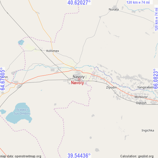
| Upper-left | 40.62027°, | 64.67605° |
| Center: | 40.08444°, | 65.37917° |
| Lower-right: | 39.54436°, | 66.0823° |
| Map W x H: | 119.6×119.6 km | = 74.3×74.3mi |
| max Lat: | 43.77877° ⇑69% North |
| Navoiy: | 40.08444° |
| min Lat: | ⇓31% South 37.22417° |
| min Long | Navoiy | max Long |
| 58.84596° | 65.37917° | 72.76177° |
| W 29.3%⇐ | ⇒70.7% E |
Elevation
Elevation of Navoiy is 392 m = 1286 ft, and this is 41.8 m = 137 ft below average elevation for this country.
| Max E: |
1464 m = 4803 ft | 57.5% |
| Avg. | 433.8 m = 1423 ft | |
| Navoiy | 392 m = 1286 ft | |
Min E: |
50 m = 164 ft | 42.5% |
See also: Navoiy elevation on elevation.city.
Geographical zone
Navoiy is located in North temperate zone (between Tropic of Cancer and the Arctic Circle). Distance of this Northern Tropic circle is 1851.1 km =1150.2 mi to South.| Distance of | km | miles | from Navoiy |
|---|---|---|---|
| North Pole | 5550.1 | 3448.7 | to North |
| Arctic Circle | 2944.2 | 1829.4 | to North |
| Tropic Cancer | 1851.1 | 1150.2 | to South |
| Equator | 4457 | 2769.5 | to South |


Nearby cities:
15 places around Navoiy: (largest is in red/bold)
• Beshrabot
13.1 km =8.1 mi,  343°
343°
• Ghijduwon
59.2 km =36.8 mi,  271°
271°
• Karmana Shahri
5.9 km =3.7 mi,  356°
356°
• Kattaqo‘rg‘on
77.5 km =48.2 mi,  105°
105°
• Konimex
29.1 km =18.1 mi,  316°
316°
• Nurota
59.2 km =36.8 mi,  26°
26°
• Nurota Shahri
59.5 km =37 mi, 25°
• Oqtosh
49.9 km =31 mi, 111°
• Payshanba
73.5 km =45.7 mi,  96°
96°
• Qiziltepa
45.4 km =28.2 mi,  262°
262°
• Qiziltepa Shahri
47.3 km =29.4 mi, 262°
• Qorovulbozor Shahri
80.8 km =50.2 mi,  216°
216°
• Shofirkon
74.8 km =46.5 mi, 273°
• Wobkent
73.8 km =45.9 mi, 265°
• Yangirabot
49.9 km =31 mi, 97°
Sources, notices
• [Note1] Compared only with cities in Uzbekistan existing in our database
• [Src1] Map data: © OpenStreetMap contributors (CC-BY-SA)
• [Src2] Other city data from geonames.org with taken over terms of usage.
• [Src3] Geographical zone / Annual Mean Temperature by Robert A. Rohde @ Wikipedia
