Pueblo Nuevo El Chivo geodata
Pueblo Nuevo El Chivo (Zulia) is a seat of a second-order administrative division; located in Venezuela in America/Caracas (GMT-4) time zone. In our database, there are 108 cities with bigger population. Compared to other cities in Venezuela, 64.4% of cities are located further ↑North; 87.8% of cities are located further →East and 84.7% of cities have higher elevation than Pueblo Nuevo El Chivo. Note1
Current local time in Pueblo Nuevo El Chivo:
02:01 PM, ThursdayDifference from your time zone: hours


Pueblo Nuevo El Chivo GPS coordinates[2]
8° 57' 44.964" North, 71° 36' 27.144" West
| Map corner | latitude | longitude |
|---|---|---|
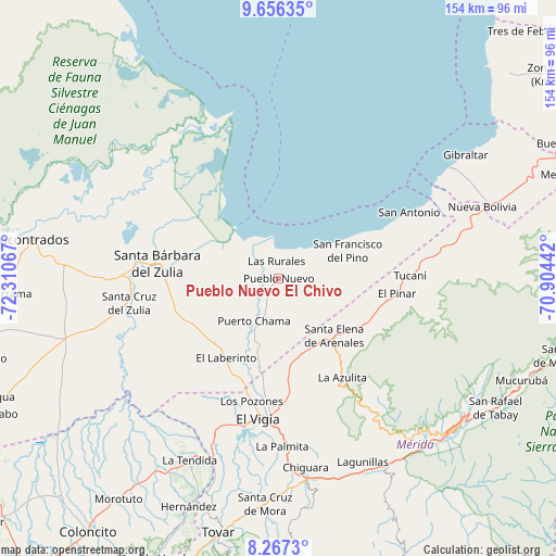
| Upper-left | 9.65635°, | -72.31067° |
| Center: | 8.96249°, | -71.60754° |
| Lower-right: | 8.2673°, | -70.90442° |
| Map W x H: | 154.4×154.5 km | = 95.9×96mi |
| max Lat: | 11.94788° ⇑64.4% North |
| Pueblo Nuevo El Chivo: | 8.96249° |
| min Lat: | ⇓35.6% South 1.92027° |
| min Long | Pueblo Nuevo El | max Long |
| -72.55212° | -71.60754° | -60.99778° |
| W 12.2%⇐ | ⇒87.8% E |
Elevation
Elevation of Pueblo Nuevo El Chivo is 32 m = 105 ft, and this is 348.6 m = 1144 ft below average elevation for this country.
| Max E: |
2986 m = 9797 ft | 84.7% |
| Avg. | 380.6 m = 1249 ft | |
| Pueblo Nuevo El Chivo | 32 m = 105 ft | |
Min E: |
-4 m = -13 ft | 15.3% |
See also: Venezuela elevation on elevation.city.
Geographical zone
Pueblo Nuevo El Chivo is located in North Torrid zone (between Equator and Tropic of Cancer). Distance of Equator is 996.5 km =619.2 mi to South.| Distance of | km | miles | from Pueblo Nuevo El Chivo |
|---|---|---|---|
| North Pole | 9010.5 | 5598.9 | to North |
| Arctic Circle | 6404.6 | 3979.6 | to North |
| Tropic Cancer | 1609.4 | 1000 | to North |
| Equator | 996.5 | 619.2 | to South |


Nearby cities:
15 places around Pueblo Nuevo El Chivo: (largest is in red/bold)
• Bobures
56.7 km =35.2 mi,  56°
56°
• Ejido
61.3 km =38.1 mi,  138°
138°
• El Vigía
39.2 km =24.4 mi,  187°
187°
• La Azulita
33 km =20.5 mi,  147°
147°
• La Tendida
56.3 km =35 mi,  205°
205°
• Lagunillas
56.3 km =35 mi, 154°
• Mérida
64.6 km =40.1 mi,  129°
129°
• Nueva Bolivia
60 km =37.3 mi,  70°
70°
• San Carlos del Zulia
35.3 km =21.9 mi,  276°
276°
• Santa Cruz de Mora
62.7 km =39 mi,  183°
183°
• Santa Elena de Arenales
22.2 km =13.8 mi, 135°
• Tabay
68.8 km =42.8 mi,  122°
122°
• Torondoy
65.7 km =40.8 mi,  82°
82°
• Tucaní
36.8 km =22.9 mi,  88°
88°
• Zea
67.9 km =42.2 mi,  196°
196°
Sources, notices
• [Note1] Compared only with cities in Venezuela existing in our database
• [Src1] Map data: © OpenStreetMap contributors (CC-BY-SA)
• [Src2] Other city data from geonames.org with taken over terms of usage.
• [Src3] Geographical zone / Annual Mean Temperature by Robert A. Rohde @ Wikipedia
