La Azulita geodata
La Azulita (Mérida) is a seat of a second-order administrative division; located in Venezuela in America/Caracas (GMT-4) time zone. In our database, there are 108 cities with bigger population. Compared to other cities in Venezuela, 69.7% of cities are located further ↑North; 85.5% of cities are located further →East and 90.8% of cities have lower elevation than La Azulita. Note1


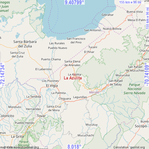
La Azulita GPS coordinates[2]
8° 42' 49.104" North, 71° 26' 39.156" West
| Map corner | latitude | longitude |
|---|---|---|
| Upper-left | 9.40799°, | -72.14734° |
| Center: | 8.71364°, | -71.44421° |
| Lower-right: | 8.018°, | -70.74109° |
| Map W x H: | 154.6×154.6 km | = 96.1×96.1mi |
| max Lat: | 11.94788° ⇑69.7% North |
| La Azulita: | 8.71364° |
| min Lat: | ⇓30.3% South 1.92027° |
| min Long | La Azulita | max Long |
| -72.55212° | -71.44421° | -60.99778° |
| W 14.5%⇐ | ⇒85.5% E |
Elevation
Elevation of La Azulita is 1110 m = 3642 ft, and this is 729.4 m = 2393 ft above average elevation for this country.
| Max E: |
2986 m = 9797 ft | 9.2% |
| La Azulita | 1110 m 3642 ft | |
| Avg. | 380.6 m = 1249 ft | |
Min E: |
-4 m = -13 ft | 90.8% |
See also: Venezuela elevation on elevation.city.
Geographical zone
La Azulita is located in North Torrid zone (between Equator and Tropic of Cancer). Distance of Equator is 968.9 km =602 mi to South.| Distance of | km | miles | from La Azulita |
|---|---|---|---|
| North Pole | 9038.2 | 5616.1 | to North |
| Arctic Circle | 6432.3 | 3996.8 | to North |
| Tropic Cancer | 1637.1 | 1017.2 | to North |
| Equator | 968.9 | 602 | to South |


Nearby cities:
15 places around La Azulita: (largest is in red/bold)
• Ejido
29.1 km =18.1 mi,  129°
129°
• El Vigía
25.9 km =16.1 mi,  244°
244°
• La Tendida
48.4 km =30.1 mi, 241°
• Lagunillas
24 km =14.9 mi,  165°
165°
• Mucuchíes
57.8 km =35.9 mi,  86°
86°
• Mucumpiz
47.5 km =29.5 mi, 134°
• Mérida
34.5 km =21.4 mi,  113°
113°
• Pueblo Nuevo El Chivo
33 km =20.5 mi,  327°
327°
• Santa Cruz de Mora
41.1 km =25.5 mi,  211°
211°
• Santa Elena de Arenales
12.1 km =7.5 mi,  348°
348°
• Tabay
41.2 km =25.6 mi,  102°
102°
• Torondoy
59.2 km =36.8 mi,  52°
52°
• Tovar
54.5 km =33.9 mi,  218°
218°
• Tucaní
34.2 km =21.3 mi,  33°
33°
• Zea
52.9 km =32.9 mi, 224°
Sources, notices
• [Note1] Compared only with cities in Venezuela existing in our database
• [Src1] Map data: © OpenStreetMap contributors (CC-BY-SA)
• [Src2] Other city data from geonames.org with taken over terms of usage.
• [Src3] Geographical zone / Annual Mean Temperature by Robert A. Rohde @ Wikipedia
