Michelena geodata
Michelena (Táchira) is a seat of a second-order administrative division; located in Venezuela in America/Caracas (GMT-4) time zone. In our database, there are 108 cities with bigger population. Compared to other cities in Venezuela, 88% of cities are located further ↑North; 96.7% of cities are located further →East and 93.9% of cities have lower elevation than Michelena. Note1


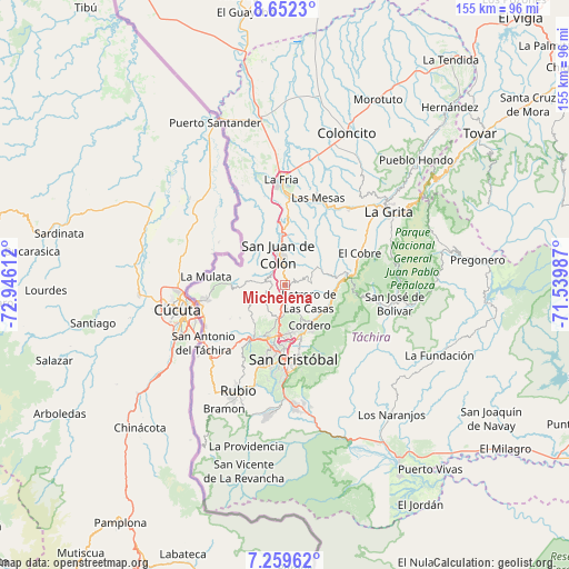
Michelena GPS coordinates[2]
7° 57' 23.58" North, 72° 14' 34.764" West
| Map corner | latitude | longitude |
|---|---|---|
| Upper-left | 8.6523°, | -72.94612° |
| Center: | 7.95655°, | -72.24299° |
| Lower-right: | 7.25962°, | -71.53987° |
| Map W x H: | 154.9×154.9 km | = 96.3×96.3mi |
| max Lat: | 11.94788° ⇑88% North |
| Michelena: | 7.95655° |
| min Lat: | ⇓12% South 1.92027° |
| min Long | Michelena | max Long |
| -72.55212° | -72.24299° | -60.99778° |
| W 3.3%⇐ | ⇒96.7% E |
Elevation
Elevation of Michelena is 1248 m = 4094 ft, and this is 867.4 m = 2846 ft above average elevation for this country.
| Max E: |
2986 m = 9797 ft | 6.1% |
| Michelena | 1248 m 4094 ft | |
| Avg. | 380.6 m = 1249 ft | |
Min E: |
-4 m = -13 ft | 93.9% |
See also: Venezuela elevation on elevation.city.
Geographical zone
Michelena is located in North Torrid zone (between Equator and Tropic of Cancer). Distance of Equator is 884.7 km =549.7 mi to South.| Distance of | km | miles | from Michelena |
|---|---|---|---|
| North Pole | 9122.4 | 5668.4 | to North |
| Arctic Circle | 6516.5 | 4049.2 | to North |
| Tropic Cancer | 1721.2 | 1069.5 | to North |
| Equator | 884.7 | 549.7 | to South |


Nearby cities:
15 places around Michelena: (largest is in red/bold)
• Capacho Nuevo
16.3 km =10.1 mi,  206°
206°
• Capacho Viejo
16.5 km =10.3 mi, 210°
• Colón
8.5 km =5.3 mi,  346°
346°
• Cordero
13 km =8.1 mi,  148°
148°
• El Cobre
22.2 km =13.8 mi,  66°
66°
• La Fría
28.8 km =17.9 mi,  358°
358°
• Las Mesas
25.6 km =15.9 mi,  21°
21°
• Lobatera
3 km =1.9 mi,  189°
189°
• Palmira
13.4 km =8.3 mi,  172°
172°
• Queniquea
25.6 km =15.9 mi,  99°
99°
• San Antonio del Táchira
27.1 km =16.8 mi,  234°
234°
• San Cristóbal
21.2 km =13.2 mi, 174°
• Seboruco
28.1 km =17.5 mi,  41°
41°
• Táriba
15.5 km =9.6 mi, 172°
• Ureña
22.9 km =14.2 mi,  259°
259°
Sources, notices
• [Note1] Compared only with cities in Venezuela existing in our database
• [Src1] Map data: © OpenStreetMap contributors (CC-BY-SA)
• [Src2] Other city data from geonames.org with taken over terms of usage.
• [Src3] Geographical zone / Annual Mean Temperature by Robert A. Rohde @ Wikipedia
