Lobatera geodata
Lobatera (Táchira) is a seat of a second-order administrative division; located in Venezuela in America/Caracas (GMT-4) time zone. In our database, there are 108 cities with bigger population. Compared to other cities in Venezuela, 88.3% of cities are located further ↑North; 96.9% of cities are located further →East and 87.8% of cities have lower elevation than Lobatera. Note1


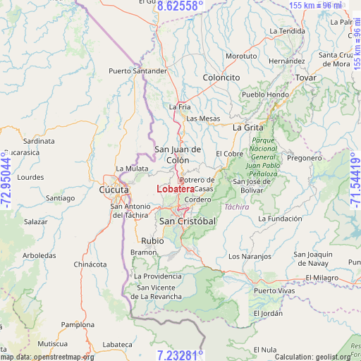
Lobatera GPS coordinates[2]
7° 55' 47.208" North, 72° 14' 50.316" West
| Map corner | latitude | longitude |
|---|---|---|
| Upper-left | 8.62558°, | -72.95044° |
| Center: | 7.92978°, | -72.24731° |
| Lower-right: | 7.23281°, | -71.54419° |
| Map W x H: | 154.9×154.9 km | = 96.3×96.3mi |
| max Lat: | 11.94788° ⇑88.3% North |
| Lobatera: | 7.92978° |
| min Lat: | ⇓11.7% South 1.92027° |
| min Long | Lobatera | max Long |
| -72.55212° | -72.24731° | -60.99778° |
| W 3.1%⇐ | ⇒96.9% E |
Elevation
Elevation of Lobatera is 960 m = 3150 ft, and this is 579.4 m = 1901 ft above average elevation for this country.
| Max E: |
2986 m = 9797 ft | 12.2% |
| Lobatera | 960 m 3150 ft | |
| Avg. | 380.6 m = 1249 ft | |
Min E: |
-4 m = -13 ft | 87.8% |
See also: Venezuela elevation on elevation.city.
Geographical zone
Lobatera is located in North Torrid zone (between Equator and Tropic of Cancer). Distance of Equator is 881.7 km =547.9 mi to South.| Distance of | km | miles | from Lobatera |
|---|---|---|---|
| North Pole | 9125.4 | 5670.3 | to North |
| Arctic Circle | 6519.5 | 4051 | to North |
| Tropic Cancer | 1724.2 | 1071.4 | to North |
| Equator | 881.7 | 547.9 | to South |


Nearby cities:
15 places around Lobatera: (largest is in red/bold)
• Capacho Nuevo
13.5 km =8.4 mi,  209°
209°
• Capacho Viejo
13.7 km =8.5 mi,  215°
215°
• Colón
11.4 km =7.1 mi,  352°
352°
• Cordero
10.9 km =6.8 mi,  137°
137°
• El Cobre
24 km =14.9 mi,  60°
60°
• Las Mesas
28.5 km =17.7 mi,  19°
19°
• Michelena
3 km =1.9 mi,  9°
9°
• Palmira
10.5 km =6.5 mi,  168°
168°
• Queniquea
25.8 km =16 mi,  93°
93°
• Rubio
28.1 km =17.5 mi, 205°
• San Antonio del Táchira
25.1 km =15.6 mi,  239°
239°
• San Cristóbal
18.3 km =11.4 mi, 172°
• San Josecito
30 km =18.6 mi, 174°
• Táriba
12.6 km =7.8 mi, 168°
• Ureña
22 km =13.7 mi,  266°
266°
Sources, notices
• [Note1] Compared only with cities in Venezuela existing in our database
• [Src1] Map data: © OpenStreetMap contributors (CC-BY-SA)
• [Src2] Other city data from geonames.org with taken over terms of usage.
• [Src3] Geographical zone / Annual Mean Temperature by Robert A. Rohde @ Wikipedia
