Guanare geodata
Guanare (Portuguesa) is a seat of a first-order administrative division; located in Venezuela in America/Caracas (GMT-4) time zone. With population of 112,286 people, there are 38 cities with bigger population in this country. Compared to other cities in Venezuela, 62.1% of cities are located further ↑North; 62.1% of cities are located further →East and 53.9% of cities have higher elevation than Guanare. Note1


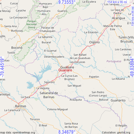
Guanare GPS coordinates[2]
9° 2' 30.588" North, 69° 44' 31.416" West
| Map corner | latitude | longitude |
|---|---|---|
| Upper-left | 9.73553°, | -70.44519° |
| Center: | 9.04183°, | -69.74206° |
| Lower-right: | 8.34679°, | -69.03894° |
| Map W x H: | 154.4×154.4 km | = 95.9×95.9mi |
| max Lat: | 11.94788° ⇑62.1% North |
| Guanare: | 9.04183° |
| min Lat: | ⇓37.9% South 1.92027° |
| min Long | Guanare | max Long |
| -72.55212° | -69.74206° | -60.99778° |
| W 37.9%⇐ | ⇒62.1% E |
Elevation
Elevation of Guanare is 164 m = 538 ft, and this is 216.6 m = 711 ft below average elevation for this country.
| Max E: |
2986 m = 9797 ft | 53.9% |
| Avg. | 380.6 m = 1249 ft | |
| Guanare | 164 m = 538 ft | |
Min E: |
-4 m = -13 ft | 46.1% |
See also: Guanare elevation on elevation.city.
Geographical zone
Guanare is located in North Torrid zone (between Equator and Tropic of Cancer). Distance of Equator is 1005.4 km =624.7 mi to South.| Distance of | km | miles | from Guanare |
|---|---|---|---|
| North Pole | 9001.7 | 5593.4 | to North |
| Arctic Circle | 6395.8 | 3974.2 | to North |
| Tropic Cancer | 1600.6 | 994.6 | to North |
| Equator | 1005.4 | 624.7 | to South |


Nearby cities:
15 places around Guanare: (largest is in red/bold)
• Arauquita
38.2 km =23.7 mi,  165°
165°
• Barrancas
50.6 km =31.4 mi,  233°
233°
• Biscucuy
44.2 km =27.5 mi,  323°
323°
• Boconoito
34 km =21.1 mi, 230°
• Boconó
60.6 km =37.7 mi,  292°
292°
• Campo Elías
52.4 km =32.6 mi, 318°
• La Yuca
59.3 km =36.8 mi, 234°
• Masparrito
61.6 km =38.3 mi,  265°
265°
• Obispos
62.7 km =39 mi,  219°
219°
• Ospino
42.4 km =26.3 mi,  48°
48°
• Papelón
32.9 km =20.4 mi,  109°
109°
• Paraíso de Chabasquén
49 km =30.4 mi,  332°
332°
• Sabaneta
38.4 km =23.9 mi,  213°
213°
• Santa Rosa
67 km =41.6 mi,  176°
176°
• Veguitas
36.9 km =22.9 mi, 228°
Sources, notices
• [Note1] Compared only with cities in Venezuela existing in our database
• [Src1] Map data: © OpenStreetMap contributors (CC-BY-SA)
• [Src2] Other city data from geonames.org with taken over terms of usage.
• [Src3] Geographical zone / Annual Mean Temperature by Robert A. Rohde @ Wikipedia
