Elorza geodata
Elorza (Apure) is a seat of a second-order administrative division; located in Venezuela in America/Caracas (GMT-4) time zone. In our database, there are 108 cities with bigger population. Compared to other cities in Venezuela, 98% of cities are located further ↑North; 58.5% of cities are located further →East and 66.9% of cities have higher elevation than Elorza. Note1


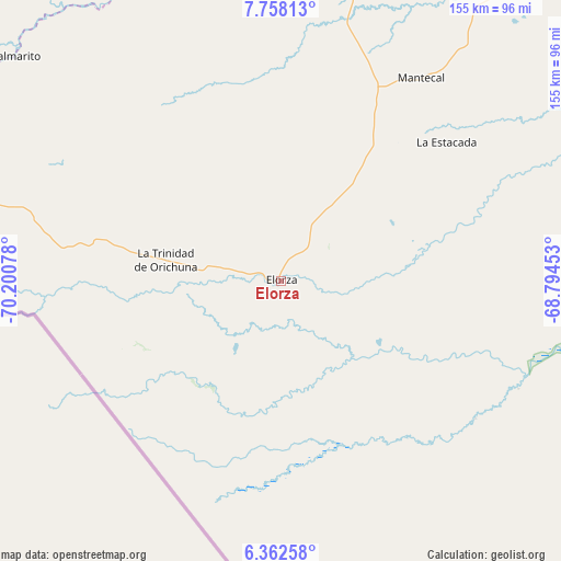
Elorza GPS coordinates[2]
7° 3' 39.168" North, 69° 29' 51.54" West
| Map corner | latitude | longitude |
|---|---|---|
| Upper-left | 7.75813°, | -70.20078° |
| Center: | 7.06088°, | -69.49765° |
| Lower-right: | 6.36258°, | -68.79453° |
| Map W x H: | 155.2×155.2 km | = 96.4×96.4mi |
| max Lat: | 11.94788° ⇑98% North |
| Elorza: | 7.06088° |
| min Lat: | ⇓2% South 1.92027° |
| min Long | Elorza | max Long |
| -72.55212° | -69.49765° | -60.99778° |
| W 41.5%⇐ | ⇒58.5% E |
Elevation
Elevation of Elorza is 94 m = 308 ft, and this is 286.6 m = 940 ft below average elevation for this country.
| Max E: |
2986 m = 9797 ft | 66.9% |
| Avg. | 380.6 m = 1249 ft | |
| Elorza | 94 m = 308 ft | |
Min E: |
-4 m = -13 ft | 33.1% |
See also: Venezuela elevation on elevation.city.
Geographical zone
Elorza is located in North Torrid zone (between Equator and Tropic of Cancer). Distance of Equator is 785.1 km =487.8 mi to South.| Distance of | km | miles | from Elorza |
|---|---|---|---|
| North Pole | 9222 | 5730.3 | to North |
| Arctic Circle | 6616.1 | 4111.1 | to North |
| Tropic Cancer | 1820.8 | 1131.4 | to North |
| Equator | 785.1 | 487.8 | to South |


Nearby cities:
15 places around Elorza: (largest is in red/bold)
• Bruzual
111.5 km =69.3 mi,  9°
9°
• Ciudad De Nutrias
116.9 km =72.6 mi, 10°
• Dolores
136.5 km =84.8 mi,  356°
356°
• Guasdualito
137.7 km =85.6 mi,  278°
278°
• La Luz
152.5 km =94.8 mi,  346°
346°
• Las Casitas del Vegon de Nutrias
131.1 km =81.5 mi,  3°
3°
• Libertad
141.6 km =88 mi, 354°
• Maporal
120.7 km =75 mi,  302°
302°
• Puerto de Nutrias
114.6 km =71.2 mi, 10°
• San Antonio
154.4 km =95.9 mi,  49°
49°
• San Rafael de Canaguá
121.3 km =75.4 mi,  332°
332°
• San Silvestre
151 km =93.8 mi, 333°
• Santa Catalina
115.3 km =71.6 mi,  33°
33°
• Santa Inés
140.7 km =87.4 mi,  341°
341°
• Santa Lucía
119.8 km =74.4 mi, 345°
Sources, notices
• [Note1] Compared only with cities in Venezuela existing in our database
• [Src1] Map data: © OpenStreetMap contributors (CC-BY-SA)
• [Src2] Other city data from geonames.org with taken over terms of usage.
• [Src3] Geographical zone / Annual Mean Temperature by Robert A. Rohde @ Wikipedia
