Hương Canh geodata
Hương Canh (Vĩnh Phúc) is a seat of a second-order administrative division; located in Vietnam in Asia/Ho_Chi_Minh (GMT+7) time zone. In our database, there are 94 cities with bigger population. Compared to other cities in Vietnam, 81.9% of cities are located further ↓South; 70.8% of cities are located further →East and 51.5% of cities have lower elevation than Hương Canh. Note1


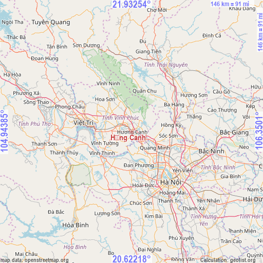
Hương Canh GPS coordinates[2]
21° 16' 43.752" North, 105° 38' 49.092" East
| Map corner | latitude | longitude |
|---|---|---|
| Upper-left | 21.93254°, | 104.94385° |
| Center: | 21.27882°, | 105.64697° |
| Lower-right: | 20.62218°, | 106.3501° |
| Map W x H: | 145.7×145.7 km | = 90.5×90.5mi |
| max Lat: | 23.27841° ⇑18.1% North |
| Hương Canh: | 21.27882° |
| min Lat: | ⇓81.9% South 8.65724° |
| min Long | Hương Canh | max Long |
| 102.4579° | 105.64697° | 112.72541° |
| W 29.2%⇐ | ⇒70.8% E |
Elevation
Elevation of Hương Canh is 15 m = 49 ft, and this is 114.5 m = 376 ft below average elevation for this country.
| Max E: |
1592 m = 5223 ft | 48.5% |
| Avg. | 129.5 m = 425 ft | |
| Hương Canh | 15 m = 49 ft | |
Min E: |
-1 m = -3 ft | 51.5% |
See also: Vietnam elevation on elevation.city.
Geographical zone
Hương Canh is located in North Torrid zone (between Equator and Tropic of Cancer). Distance of this Northern Tropic circle is 239.9 km =149.1 mi to North.| Distance of | km | miles | from Hương Canh |
|---|---|---|---|
| North Pole | 7641.1 | 4748 | to North |
| Arctic Circle | 5035.2 | 3128.7 | to North |
| Tropic Cancer | 239.9 | 149.1 | to North |
| Equator | 2366 | 1470.2 | to South |


Nearby cities:
15 places around Hương Canh: (largest is in red/bold)
• Hợp Hòa
15.2 km =9.4 mi,  314°
314°
• Liên Quan
25.6 km =15.9 mi,  195°
195°
• Lập Thạch
24.5 km =15.2 mi, 308°
• Mê Linh
13.1 km =8.1 mi,  144°
144°
• Phùng
21.1 km =13.1 mi,  176°
176°
• Phúc Thọ
22.2 km =13.8 mi,  208°
208°
• Phúc Yên
7.6 km =4.7 mi,  127°
127°
• Sóc Sơn
21.1 km =13.1 mi,  96°
96°
• Sơn Tây
21.2 km =13.2 mi,  223°
223°
• Trai Ngau
13.2 km =8.2 mi,  345°
345°
• Trôi
24.1 km =15 mi,  165°
165°
• Tây Đằng
25 km =15.5 mi,  248°
248°
• Vĩnh Tường
15.6 km =9.7 mi,  243°
243°
• Vĩnh Yên
5.5 km =3.4 mi, 307°
• Yên Lạc
9 km =5.6 mi, 238°
Sources, notices
• [Note1] Compared only with cities in Vietnam existing in our database
• [Src1] Map data: © OpenStreetMap contributors (CC-BY-SA)
• [Src2] Other city data from geonames.org with taken over terms of usage.
• [Src3] Geographical zone / Annual Mean Temperature by Robert A. Rohde @ Wikipedia
