Hương Sơn geodata
Hương Sơn (Thái Nguyên) is a seat of a second-order administrative division; located in Vietnam in Asia/Ho_Chi_Minh (GMT+7) time zone. In our database, there are 94 cities with bigger population. Compared to other cities in Vietnam, 85.3% of cities are located further ↓South; 56.4% of cities are located further →East and 59.9% of cities have lower elevation than Hương Sơn. Note1


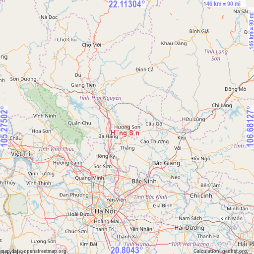
Hương Sơn GPS coordinates[2]
21° 27' 36.504" North, 105° 58' 41.304" East
| Map corner | latitude | longitude |
|---|---|---|
| Upper-left | 22.11304°, | 105.27502° |
| Center: | 21.46014°, | 105.97814° |
| Lower-right: | 20.8043°, | 106.68127° |
| Map W x H: | 145.5×145.5 km | = 90.4×90.4mi |
| max Lat: | 23.27841° ⇑14.7% North |
| Hương Sơn: | 21.46014° |
| min Lat: | ⇓85.3% South 8.65724° |
| min Long | Hương Sơn | max Long |
| 102.4579° | 105.97814° | 112.72541° |
| W 43.6%⇐ | ⇒56.4% E |
Elevation
Elevation of Hương Sơn is 23 m = 75 ft, and this is 106.5 m = 349 ft below average elevation for this country.
| Max E: |
1592 m = 5223 ft | 40.1% |
| Avg. | 129.5 m = 425 ft | |
| Hương Sơn | 23 m = 75 ft | |
Min E: |
-1 m = -3 ft | 59.9% |
See also: Vietnam elevation on elevation.city.
Geographical zone
Hương Sơn is located in North Torrid zone (between Equator and Tropic of Cancer). Distance of this Northern Tropic circle is 219.8 km =136.6 mi to North.| Distance of | km | miles | from Hương Sơn |
|---|---|---|---|
| North Pole | 7620.9 | 4735.4 | to North |
| Arctic Circle | 5015 | 3116.2 | to North |
| Tropic Cancer | 219.8 | 136.6 | to North |
| Equator | 2386.1 | 1482.7 | to South |


Nearby cities:
15 places around Hương Sơn: (largest is in red/bold)
• Bích Động
24.3 km =15.1 mi,  148°
148°
• Bắc Giang
30.6 km =19 mi,  132°
132°
• Bắc Ninh
32.1 km =19.9 mi,  161°
161°
• Cao Thượng
17.6 km =10.9 mi,  117°
117°
• Chùa Hang
23 km =14.3 mi,  322°
322°
• Chờ
29.6 km =18.4 mi,  184°
184°
• Cung Kiệm
35.8 km =22.2 mi, 148°
• Cầu Gồ
15.5 km =9.6 mi,  83°
83°
• Hữu Lũng
38.3 km =23.8 mi, 82°
• Lim
35.4 km =22 mi,  172°
172°
• Phúc Yên
37.6 km =23.4 mi,  228°
228°
• Sóc Sơn
26.2 km =16.3 mi,  210°
210°
• Thái Nguyên
20.1 km =12.5 mi, 317°
• Thắng
11.7 km =7.3 mi, 177°
• Đông Anh
38.1 km =23.7 mi,  200°
200°
Sources, notices
• [Note1] Compared only with cities in Vietnam existing in our database
• [Src1] Map data: © OpenStreetMap contributors (CC-BY-SA)
• [Src2] Other city data from geonames.org with taken over terms of usage.
• [Src3] Geographical zone / Annual Mean Temperature by Robert A. Rohde @ Wikipedia
