Lộc Ninh geodata
Lộc Ninh (Bình Phước) is a seat of a second-order administrative division; located in Vietnam in Asia/Ho_Chi_Minh (GMT+7) time zone. In our database, there are 94 cities with bigger population. Compared to other cities in Vietnam, 68.2% of cities are located further ↑North; 65.1% of cities are located further ←West and 75.9% of cities have lower elevation than Lộc Ninh. Note1


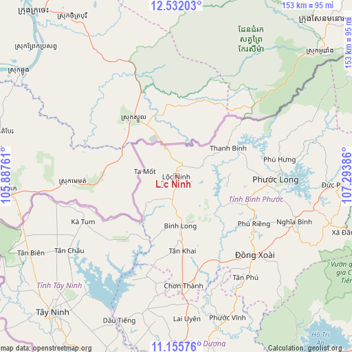
Lộc Ninh GPS coordinates[2]
11° 50' 41.136" North, 106° 35' 26.628" East
| Map corner | latitude | longitude |
|---|---|---|
| Upper-left | 12.53203°, | 105.88761° |
| Center: | 11.84476°, | 106.59073° |
| Lower-right: | 11.15576°, | 107.29386° |
| Map W x H: | 153×153 km | = 95.1×95.1mi |
| max Lat: | 23.27841° ⇑68.2% North |
| Lộc Ninh: | 11.84476° |
| min Lat: | ⇓31.8% South 8.65724° |
| min Long | Lộc Ninh | max Long |
| 102.4579° | 106.59073° | 112.72541° |
| W 65.1%⇐ | ⇒34.9% E |
Elevation
Elevation of Lộc Ninh is 112 m = 367 ft, and this is 17.5 m = 57 ft below average elevation for this country.
| Max E: |
1592 m = 5223 ft | 24.1% |
| Avg. | 129.5 m = 425 ft | |
| Lộc Ninh | 112 m = 367 ft | |
Min E: |
-1 m = -3 ft | 75.9% |
See also: Vietnam elevation on elevation.city.
Geographical zone
Lộc Ninh is located in North Torrid zone (between Equator and Tropic of Cancer). Distance of this Northern Tropic circle is 1288.9 km =800.9 mi to North.| Distance of | km | miles | from Lộc Ninh |
|---|---|---|---|
| North Pole | 8690 | 5399.7 | to North |
| Arctic Circle | 6084.2 | 3780.5 | to North |
| Tropic Cancer | 1288.9 | 800.9 | to North |
| Equator | 1317 | 818.3 | to South |


Nearby cities:
15 places around Lộc Ninh: (largest is in red/bold)
• Bình Long
22 km =13.7 mi,  175°
175°
• Bù Đốp
25.9 km =16.1 mi,  61°
61°
• Châu Thành
85.2 km =52.9 mi,  225°
225°
• Chơn Thành
46.6 km =29 mi,  174°
174°
• Don Luan
46.9 km =29.1 mi,  137°
137°
• Dương Minh Châu
64.5 km =40.1 mi,  217°
217°
• Dầu Tiếng
68.3 km =42.4 mi,  201°
201°
• Hòa Thành
79.8 km =49.6 mi, 219°
• Phú Khương
79.9 km =49.6 mi, 218°
• Tân Biên
71.4 km =44.4 mi,  242°
242°
• Tân Châu
56 km =34.8 mi, 234°
• Tân Phú
53.2 km =33.1 mi,  145°
145°
• Tây Ninh
80.1 km =49.8 mi, 222°
• Uyen Hung
87.3 km =54.2 mi, 165°
• Đức Phong
71.2 km =44.2 mi,  92°
92°
Sources, notices
• [Note1] Compared only with cities in Vietnam existing in our database
• [Src1] Map data: © OpenStreetMap contributors (CC-BY-SA)
• [Src2] Other city data from geonames.org with taken over terms of usage.
• [Src3] Geographical zone / Annual Mean Temperature by Robert A. Rohde @ Wikipedia
