Vĩnh Long geodata
Vĩnh Long is a seat of a first-order administrative division; located in Vietnam in Asia/Ho_Chi_Minh (GMT+7) time zone. With population of 103,314 people, there are 35 cities with bigger population in this country. Compared to other cities in Vietnam, 88.7% of cities are located further ↑North; 56.8% of cities are located further →East and 99.2% of cities have higher elevation than Vĩnh Long. Note1


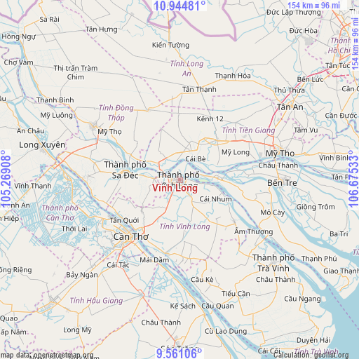
Vĩnh Long GPS coordinates[2]
10° 15' 13.284" North, 105° 58' 19.92" East
| Map corner | latitude | longitude |
|---|---|---|
| Upper-left | 10.94481°, | 105.26908° |
| Center: | 10.25369°, | 105.9722° |
| Lower-right: | 9.56106°, | 106.67533° |
| Map W x H: | 153.9×153.9 km | = 95.6×95.6mi |
| max Lat: | 23.27841° ⇑88.7% North |
| Vĩnh Long: | 10.25369° |
| min Lat: | ⇓11.3% South 8.65724° |
| min Long | Vĩnh Long | max Long |
| 102.4579° | 105.9722° | 112.72541° |
| W 43.2%⇐ | ⇒56.8% E |
Elevation
Elevation of Vĩnh Long is 1 m = 3 ft, and this is 128.5 m = 422 ft below average elevation for this country.
| Max E: |
1592 m = 5223 ft | 99.2% |
| Avg. | 129.5 m = 425 ft | |
| Vĩnh Long | 1 m = 3 ft | |
Min E: |
-1 m = -3 ft | 0.8% |
See also: Vĩnh Long elevation on elevation.city.
Geographical zone
Vĩnh Long is located in North Torrid zone (between Equator and Tropic of Cancer). Distance of Equator is 1140.1 km =708.4 mi to South.| Distance of | km | miles | from Vĩnh Long |
|---|---|---|---|
| North Pole | 8867 | 5509.7 | to North |
| Arctic Circle | 6261.1 | 3890.5 | to North |
| Tropic Cancer | 1465.8 | 910.8 | to North |
| Equator | 1140.1 | 708.4 | to South |


Nearby cities:
15 places around Vĩnh Long: (largest is in red/bold)
• An Hòa
25.4 km =15.8 mi,  280°
280°
• Bình Minh
26.4 km =16.4 mi,  218°
218°
• Bình Thủy
32.3 km =20.1 mi,  231°
231°
• Chợ Lách
16.1 km =10 mi,  87°
87°
• Cái Nhum
17.5 km =10.9 mi,  120°
120°
• Cái Tàu Hạ
11.2 km =7 mi,  273°
273°
• Cần Thơ
31.4 km =19.5 mi, 219°
• Lai Vung
34.2 km =21.3 mi, 276°
• Long Hồ
8.1 km =5 mi,  147°
147°
• Mỹ Phước
34.6 km =21.5 mi,  44°
44°
• Sa Dec
24 km =14.9 mi, 279°
• Tam Bình
23.1 km =14.4 mi,  172°
172°
• Trà Ôn
32.8 km =20.4 mi,  189°
189°
• Vũng Liêm
29.2 km =18.1 mi,  126°
126°
• Ấp Tân Ngãi
34.1 km =21.2 mi, 93°
Sources, notices
• [Note1] Compared only with cities in Vietnam existing in our database
• [Src1] Map data: © OpenStreetMap contributors (CC-BY-SA)
• [Src2] Other city data from geonames.org with taken over terms of usage.
• [Src3] Geographical zone / Annual Mean Temperature by Robert A. Rohde @ Wikipedia
