Thị Trấn Long Điền geodata
Thị Trấn Long Điền (Bà Rịa-Vũng Tàu) is a seat of a second-order administrative division; located in Vietnam in Asia/Ho_Chi_Minh (GMT+7) time zone. In our database, there are 94 cities with bigger population. Compared to other cities in Vietnam, 84.3% of cities are located further ↑North; 76.5% of cities are located further ←West and 58.1% of cities have higher elevation than Thị Trấn Long Điền. Note1


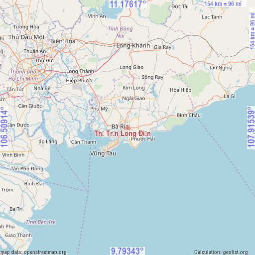
Thị Trấn Long Điền GPS coordinates[2]
10° 29' 8.052" North, 107° 12' 44.136" East
| Map corner | latitude | longitude |
|---|---|---|
| Upper-left | 11.17617°, | 106.50914° |
| Center: | 10.48557°, | 107.21226° |
| Lower-right: | 9.79343°, | 107.91539° |
| Map W x H: | 153.7×153.7 km | = 95.5×95.5mi |
| max Lat: | 23.27841° ⇑84.3% North |
| Thị Trấn Long Điền: | 10.48557° |
| min Lat: | ⇓15.7% South 8.65724° |
| min Long | Thị Trấn Lo | max Long |
| 102.4579° | 107.21226° | 112.72541° |
| W 76.5%⇐ | ⇒23.5% E |
Elevation
Elevation of Thị Trấn Long Điền is 11 m = 36 ft, and this is 118.5 m = 389 ft below average elevation for this country.
| Max E: |
1592 m = 5223 ft | 58.1% |
| Avg. | 129.5 m = 425 ft | |
| Thị Trấn Long Điền | 11 m = 36 ft | |
Min E: |
-1 m = -3 ft | 41.9% |
See also: Vietnam elevation on elevation.city.
Geographical zone
Thị Trấn Long Điền is located in North Torrid zone (between Equator and Tropic of Cancer). Distance of Equator is 1165.9 km =724.5 mi to South.| Distance of | km | miles | from Thị Trấn Long Điền |
|---|---|---|---|
| North Pole | 8841.2 | 5493.7 | to North |
| Arctic Circle | 6235.3 | 3874.4 | to North |
| Tropic Cancer | 1440 | 894.8 | to North |
| Equator | 1165.9 | 724.5 | to South |


Nearby cities:
15 places around Thị Trấn Long Điền: (largest is in red/bold)
• Cần Giờ
29.3 km =18.2 mi,  253°
253°
• Gia Ray
53.2 km =33.1 mi,  22°
22°
• Long Khánh
49.2 km =30.6 mi,  4°
4°
• Long Thành
44.3 km =27.5 mi,  319°
319°
• Nhà Bè
56.7 km =35.2 mi,  294°
294°
• Nhơn Trạch
44.6 km =27.7 mi,  306°
306°
• Phuoc Tho
6.4 km =4 mi,  84°
84°
• Thành Phố Bà Rịa
4.9 km =3 mi,  283°
283°
• Thị Trấn Ngải Giao
18.3 km =11.4 mi,  11°
11°
• Thị Trấn Phú Mỹ
21.7 km =13.5 mi, 307°
• Thị Trấn Phước Bửu
21.5 km =13.4 mi, 75°
• Thị Xã Phú Mỹ
12.9 km =8 mi, 315°
• Thống Nhất
52.2 km =32.4 mi,  351°
351°
• Trảng Bom
56.7 km =35.2 mi,  336°
336°
• Vũng Tàu
20.9 km =13 mi,  222°
222°
Sources, notices
• [Note1] Compared only with cities in Vietnam existing in our database
• [Src1] Map data: © OpenStreetMap contributors (CC-BY-SA)
• [Src2] Other city data from geonames.org with taken over terms of usage.
• [Src3] Geographical zone / Annual Mean Temperature by Robert A. Rohde @ Wikipedia
