Tuy Hòa geodata
Tuy Hòa (Phú Yên) is a seat of a first-order administrative division; located in Vietnam in Asia/Ho_Chi_Minh (GMT+7) time zone. With population of 69,596 people, there are 45 cities with bigger population in this country. Compared to other cities in Vietnam, 63.5% of cities are located further ↑North; 99.8% of cities are located further ←West and 71.9% of cities have higher elevation than Tuy Hòa. Note1


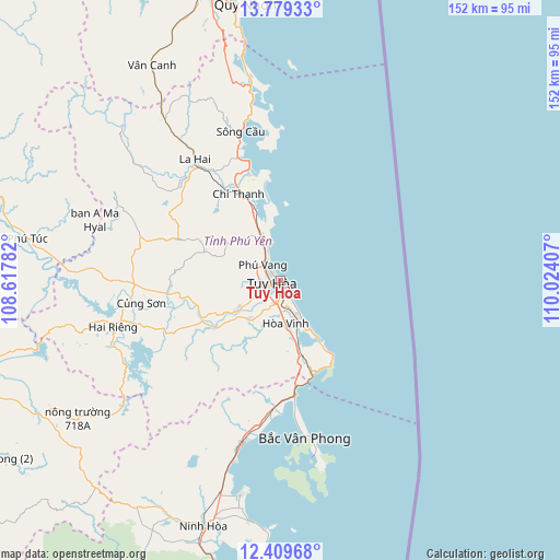
Tuy Hòa GPS coordinates[2]
13° 5' 43.656" North, 109° 19' 15.384" East
| Map corner | latitude | longitude |
|---|---|---|
| Upper-left | 13.77933°, | 108.61782° |
| Center: | 13.09546°, | 109.32094° |
| Lower-right: | 12.40968°, | 110.02407° |
| Map W x H: | 152.3×152.3 km | = 94.6×94.6mi |
| max Lat: | 23.27841° ⇑63.5% North |
| Tuy Hòa: | 13.09546° |
| min Lat: | ⇓36.5% South 8.65724° |
| min Long | Tuy Hòa | max Long |
| 102.4579° | 109.32094° | 112.72541° |
| W 99.8%⇐ | ⇒0.2% E |
Elevation
Elevation of Tuy Hòa is 8 m = 26 ft, and this is 121.5 m = 399 ft below average elevation for this country.
| Max E: |
1592 m = 5223 ft | 71.9% |
| Avg. | 129.5 m = 425 ft | |
| Tuy Hòa | 8 m = 26 ft | |
Min E: |
-1 m = -3 ft | 28.1% |
See also: Tuy Hòa elevation on elevation.city.
Geographical zone
Tuy Hòa is located in North Torrid zone (between Equator and Tropic of Cancer). Distance of this Northern Tropic circle is 1149.8 km =714.5 mi to North.| Distance of | km | miles | from Tuy Hòa |
|---|---|---|---|
| North Pole | 8551 | 5313.3 | to North |
| Arctic Circle | 5945.1 | 3694.1 | to North |
| Tropic Cancer | 1149.8 | 714.5 | to North |
| Equator | 1456.1 | 904.8 | to South |


Nearby cities:
15 places around Tuy Hòa: (largest is in red/bold)
• An Nhơn
90.8 km =56.4 mi,  345°
345°
• Chí Thạnh
26.3 km =16.3 mi,  334°
334°
• Củng Sơn
37.4 km =23.2 mi,  262°
262°
• Diên Khánh
96.7 km =60.1 mi,  194°
194°
• Hai Riêng
47.7 km =29.6 mi,  254°
254°
• La Hai
38.9 km =24.2 mi,  323°
323°
• M’Đrăk
73.7 km =45.8 mi,  238°
238°
• Nha Trang
95.5 km =59.3 mi, 188°
• Ninh Hòa
70.4 km =43.7 mi,  197°
197°
• Phú Túc
69.2 km =43 mi,  279°
279°
• Qui Nhon
76.4 km =47.5 mi, 352°
• Sông Cầu
41.4 km =25.7 mi, 345°
• Tuy Phước
83.1 km =51.6 mi, 348°
• Vân Canh
67.9 km =42.2 mi, 329°
• Vạn Giã
46.2 km =28.7 mi, 193°
Sources, notices
• [Note1] Compared only with cities in Vietnam existing in our database
• [Src1] Map data: © OpenStreetMap contributors (CC-BY-SA)
• [Src2] Other city data from geonames.org with taken over terms of usage.
• [Src3] Geographical zone / Annual Mean Temperature by Robert A. Rohde @ Wikipedia
