Al Shirūj geodata
Al Shirūj (Ḩaḑramawt) is a seat of a second-order administrative division; located in Yemen in Asia/Aden (GMT+3) time zone. In our database, there are 51 cities with bigger population. Compared to other cities in Yemen, 55.2% of cities are located further ↑North; 87% of cities are located further ←West and 65.3% of cities have higher elevation than Al Shirūj. Note1


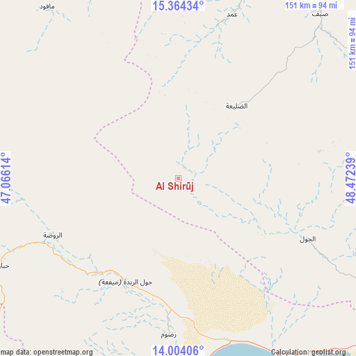
Al Shirūj GPS coordinates[2]
14° 41' 6.936" North, 47° 46' 9.336" East
| Map corner | latitude | longitude |
|---|---|---|
| Upper-left | 15.36434°, | 47.06614° |
| Center: | 14.68526°, | 47.76926° |
| Lower-right: | 14.00406°, | 48.47239° |
| Map W x H: | 151.2×151.3 km | = 94×94mi |
| max Lat: | 17.76999° ⇑55.2% North |
| Al Shirūj: | 14.68526° |
| min Lat: | ⇓44.8% South 12.18576° |
| min Long | Al Shirūj | max Long |
| 42.67107° | 47.76926° | 54.01895° |
| W 87%⇐ | ⇒13% E |
Elevation
Elevation of Al Shirūj is 1011 m = 3317 ft, and this is 293.8 m = 964 ft below average elevation for this country.
| Max E: |
2791 m = 9157 ft | 65.3% |
| Avg. | 1304.8 m = 4281 ft | |
| Al Shirūj | 1011 m = 3317 ft | |
Min E: |
4 m = 13 ft | 34.7% |
See also: Yemen elevation on elevation.city.
Geographical zone
Al Shirūj is located in North Torrid zone (between Equator and Tropic of Cancer). Distance of this Northern Tropic circle is 973.1 km =604.7 mi to North.| Distance of | km | miles | from Al Shirūj |
|---|---|---|---|
| North Pole | 8374.2 | 5203.5 | to North |
| Arctic Circle | 5768.3 | 3584.3 | to North |
| Tropic Cancer | 973.1 | 604.7 | to North |
| Equator | 1632.8 | 1014.6 | to South |


Nearby cities:
15 places around Al Shirūj: (largest is in red/bold)
• Al Jawl
60.6 km =37.7 mi,  114°
114°
• Al Māfūd
91.8 km =57 mi,  322°
322°
• Ar Rawḑah
58.3 km =36.2 mi,  245°
245°
• Ataq
102.2 km =63.5 mi,  260°
260°
• Az̧ Z̧alī‘ah
45.4 km =28.2 mi,  35°
35°
• Aţ Ţalḩ
65.7 km =40.8 mi, 322°
• Jawl al Majma‘
84.3 km =52.4 mi,  289°
289°
• Mayfa‘ah
49.7 km =30.9 mi,  203°
203°
• Maţarah
94.6 km =58.8 mi,  351°
351°
• Ruḑūm
66.8 km =41.5 mi,  182°
182°
• Said
104.3 km =64.8 mi, 247°
• Şanā’
79.5 km =49.4 mi,  359°
359°
• Şīf
92.3 km =57.4 mi, 40°
• Ḩabbān
83.2 km =51.7 mi,  243°
243°
• ‘Amd
72.1 km =44.8 mi,  18°
18°
Sources, notices
• [Note1] Compared only with cities in Yemen existing in our database
• [Src1] Map data: © OpenStreetMap contributors (CC-BY-SA)
• [Src2] Other city data from geonames.org with taken over terms of usage.
• [Src3] Geographical zone / Annual Mean Temperature by Robert A. Rohde @ Wikipedia
