Mayfa‘ah geodata
Mayfa‘ah (Shabwah) is a seat of a second-order administrative division; located in Yemen in Asia/Aden (GMT+3) time zone. In our database, there are 51 cities with bigger population. Compared to other cities in Yemen, 67.5% of cities are located further ↑North; 85.7% of cities are located further ←West and 80.8% of cities have higher elevation than Mayfa‘ah. Note1


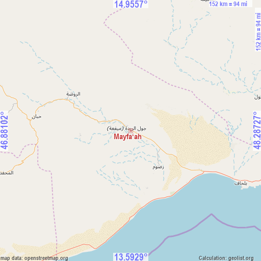
Mayfa‘ah GPS coordinates[2]
14° 16' 31.188" North, 47° 35' 2.904" East
| Map corner | latitude | longitude |
|---|---|---|
| Upper-left | 14.9557°, | 46.88102° |
| Center: | 14.27533°, | 47.58414° |
| Lower-right: | 13.5929°, | 48.28727° |
| Map W x H: | 151.5×151.5 km | = 94.1×94.1mi |
| max Lat: | 17.76999° ⇑67.5% North |
| Mayfa‘ah: | 14.27533° |
| min Lat: | ⇓32.5% South 12.18576° |
| min Long | Mayfa‘ah | max Long |
| 42.67107° | 47.58414° | 54.01895° |
| W 85.7%⇐ | ⇒14.3% E |
Elevation
Elevation of Mayfa‘ah is 394 m = 1293 ft, and this is 910.8 m = 2988 ft below average elevation for this country.
| Max E: |
2791 m = 9157 ft | 80.8% |
| Avg. | 1304.8 m = 4281 ft | |
| Mayfa‘ah | 394 m = 1293 ft | |
Min E: |
4 m = 13 ft | 19.2% |
See also: Yemen elevation on elevation.city.
Geographical zone
Mayfa‘ah is located in North Torrid zone (between Equator and Tropic of Cancer). Distance of this Northern Tropic circle is 1018.7 km =633 mi to North.| Distance of | km | miles | from Mayfa‘ah |
|---|---|---|---|
| North Pole | 8419.8 | 5231.8 | to North |
| Arctic Circle | 5813.9 | 3612.6 | to North |
| Tropic Cancer | 1018.7 | 633 | to North |
| Equator | 1587.3 | 986.3 | to South |


Nearby cities:
15 places around Mayfa‘ah: (largest is in red/bold)
• AL-khashā Lower
92.2 km =57.3 mi,  274°
274°
• AL-khashā upper
94.1 km =58.5 mi, 274°
• Al Jawl
77.7 km =48.3 mi,  74°
74°
• Al Maḩfid
76.2 km =47.3 mi,  251°
251°
• Al Shirūj
49.7 km =30.9 mi,  23°
23°
• Ar Rawḑah
39.4 km =24.5 mi,  302°
302°
• Ataq
86.1 km =53.5 mi,  289°
289°
• Az̧ Z̧alī‘ah
94.7 km =58.8 mi,  29°
29°
• Aţ Ţalḩ
99.9 km =62.1 mi,  348°
348°
• Jawl al Majma‘
94.5 km =58.7 mi,  320°
320°
• Khimār
91.2 km =56.7 mi, 273°
• Ruḑūm
27.2 km =16.9 mi,  140°
140°
• Said
76.9 km =47.8 mi, 274°
• Salābah
92.7 km =57.6 mi, 272°
• Ḩabbān
55.4 km =34.4 mi,  279°
279°
Sources, notices
• [Note1] Compared only with cities in Yemen existing in our database
• [Src1] Map data: © OpenStreetMap contributors (CC-BY-SA)
• [Src2] Other city data from geonames.org with taken over terms of usage.
• [Src3] Geographical zone / Annual Mean Temperature by Robert A. Rohde @ Wikipedia
