Ruḑūm geodata
Ruḑūm (Shabwah) is a seat of a second-order administrative division; located in Yemen in Asia/Aden (GMT+3) time zone. In our database, there are 51 cities with bigger population. Compared to other cities in Yemen, 73.1% of cities are located further ↑North; 86.4% of cities are located further ←West and 85.1% of cities have higher elevation than Ruḑūm. Note1


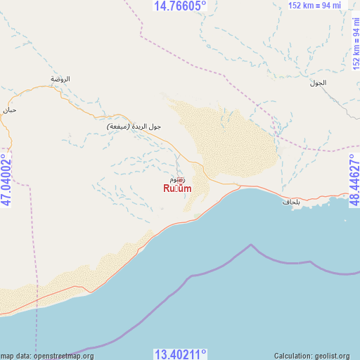
Ruḑūm GPS coordinates[2]
14° 5' 6.36" North, 47° 44' 35.304" East
| Map corner | latitude | longitude |
|---|---|---|
| Upper-left | 14.76605°, | 47.04002° |
| Center: | 14.0851°, | 47.74314° |
| Lower-right: | 13.40211°, | 48.44627° |
| Map W x H: | 151.7×151.7 km | = 94.3×94.3mi |
| max Lat: | 17.76999° ⇑73.1% North |
| Ruḑūm: | 14.0851° |
| min Lat: | ⇓26.9% South 12.18576° |
| min Long | Ruḑūm | max Long |
| 42.67107° | 47.74314° | 54.01895° |
| W 86.4%⇐ | ⇒13.6% E |
Elevation
Elevation of Ruḑūm is 166 m = 545 ft, and this is 1138.8 m = 3736 ft below average elevation for this country.
| Max E: |
2791 m = 9157 ft | 85.1% |
| Avg. | 1304.8 m = 4281 ft | |
| Ruḑūm | 166 m = 545 ft | |
Min E: |
4 m = 13 ft | 14.9% |
See also: Yemen elevation on elevation.city.
Geographical zone
Ruḑūm is located in North Torrid zone (between Equator and Tropic of Cancer). Distance of this Northern Tropic circle is 1039.8 km =646.1 mi to North.| Distance of | km | miles | from Ruḑūm |
|---|---|---|---|
| North Pole | 8440.9 | 5244.9 | to North |
| Arctic Circle | 5835.1 | 3625.8 | to North |
| Tropic Cancer | 1039.8 | 646.1 | to North |
| Equator | 1566.1 | 973.1 | to South |


Nearby cities:
15 places around Ruḑūm: (largest is in red/bold)
• AL-khashā Lower
112.9 km =70.2 mi,  284°
284°
• AL-khashā upper
114.5 km =71.1 mi, 284°
• Al Jawl
71.1 km =44.2 mi,  54°
54°
• Al Maḩfid
89.6 km =55.7 mi,  268°
268°
• Al Shirūj
66.8 km =41.5 mi,  2°
2°
• Ar Rawḑah
65.8 km =40.9 mi,  310°
310°
• Ataq
110.3 km =68.5 mi,  297°
297°
• Az̧ Z̧alī‘ah
107.7 km =66.9 mi,  15°
15°
• Aţ Ţalḩ
124.7 km =77.5 mi,  342°
342°
• Jawl al Majma‘
121.7 km =75.6 mi,  320°
320°
• Khimār
111.3 km =69.2 mi, 283°
• Mayfa‘ah
27.2 km =16.9 mi, 320°
• Said
97.7 km =60.7 mi,  286°
286°
• Salābah
112.7 km =70 mi, 283°
• Ḩabbān
77.8 km =48.3 mi, 292°
Sources, notices
• [Note1] Compared only with cities in Yemen existing in our database
• [Src1] Map data: © OpenStreetMap contributors (CC-BY-SA)
• [Src2] Other city data from geonames.org with taken over terms of usage.
• [Src3] Geographical zone / Annual Mean Temperature by Robert A. Rohde @ Wikipedia
