Dhaybīn geodata
Dhaybīn (Omran) is a seat of a second-order administrative division; located in Yemen in Asia/Aden (GMT+3) time zone. In our database, there are 51 cities with bigger population. Compared to other cities in Yemen, 81.5% of cities are located further ↓South; 59.7% of cities are located further →East and 67.9% of cities have lower elevation than Dhaybīn. Note1


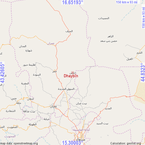
Dhaybīn GPS coordinates[2]
15° 58' 37.632" North, 44° 7' 45.012" East
| Map corner | latitude | longitude |
|---|---|---|
| Upper-left | 16.65193°, | 43.42605° |
| Center: | 15.97712°, | 44.12917° |
| Lower-right: | 15.30003°, | 44.8323° |
| Map W x H: | 150.3×150.3 km | = 93.4×93.4mi |
| max Lat: | 17.76999° ⇑18.5% North |
| Dhaybīn: | 15.97712° |
| min Lat: | ⇓81.5% South 12.18576° |
| min Long | Dhaybīn | max Long |
| 42.67107° | 44.12917° | 54.01895° |
| W 40.3%⇐ | ⇒59.7% E |
Elevation
Elevation of Dhaybīn is 1876 m = 6155 ft, and this is 571.2 m = 1874 ft above average elevation for this country.
| Max E: |
2791 m = 9157 ft | 32.1% |
| Dhaybīn | 1876 m 6155 ft | |
| Avg. | 1304.8 m = 4281 ft | |
Min E: |
4 m = 13 ft | 67.9% |
See also: Yemen elevation on elevation.city.
Geographical zone
Dhaybīn is located in North Torrid zone (between Equator and Tropic of Cancer). Distance of this Northern Tropic circle is 829.4 km =515.4 mi to North.| Distance of | km | miles | from Dhaybīn |
|---|---|---|---|
| North Pole | 8230.6 | 5114.3 | to North |
| Arctic Circle | 5624.7 | 3495 | to North |
| Tropic Cancer | 829.4 | 515.4 | to North |
| Equator | 1776.5 | 1103.9 | to South |


Nearby cities:
15 places around Dhaybīn: (largest is in red/bold)
• Al Ḩarf
43.2 km =26.8 mi,  355°
355°
• Al Ḩayfah
29.3 km =18.2 mi,  156°
156°
• Al ‘Ashshah
42.7 km =26.5 mi,  316°
316°
• An Nāşirah
41.1 km =25.5 mi,  236°
236°
• As Sūdah
37.3 km =23.2 mi,  266°
266°
• As Sūq al Jadīd
18.4 km =11.4 mi,  202°
202°
• Aş Şarārah
34.4 km =21.4 mi,  233°
233°
• Bayt Marrān
32.6 km =20.3 mi,  165°
165°
• Khamir
18.8 km =11.7 mi, 273°
• Raydah
20.4 km =12.7 mi,  207°
207°
• Saḩḩab
43.2 km =26.8 mi, 195°
• Ḩabūr
45.9 km =28.5 mi,  280°
280°
• Ḩişn Banī Sa‘d
49.6 km =30.8 mi,  48°
48°
• Ḩūth
33 km =20.5 mi,  328°
328°
• ‘Amrān
40.5 km =25.2 mi, 209°
Sources, notices
• [Note1] Compared only with cities in Yemen existing in our database
• [Src1] Map data: © OpenStreetMap contributors (CC-BY-SA)
• [Src2] Other city data from geonames.org with taken over terms of usage.
• [Src3] Geographical zone / Annual Mean Temperature by Robert A. Rohde @ Wikipedia
