Al ‘Abr geodata
Al ‘Abr (Ḩaḑramawt) is a seat of a second-order administrative division; located in Yemen in Asia/Aden (GMT+3) time zone. In our database, there are 51 cities with bigger population. Compared to other cities in Yemen, 84.7% of cities are located further ↓South; 84.4% of cities are located further ←West and 68.2% of cities have higher elevation than Al ‘Abr. Note1


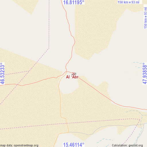
Al ‘Abr GPS coordinates[2]
16° 8' 15.72" North, 47° 14' 7.62" East
| Map corner | latitude | longitude |
|---|---|---|
| Upper-left | 16.81195°, | 46.53233° |
| Center: | 16.1377°, | 47.23545° |
| Lower-right: | 15.46114°, | 47.93858° |
| Map W x H: | 150.2×150.2 km | = 93.3×93.3mi |
| max Lat: | 17.76999° ⇑15.3% North |
| Al ‘Abr: | 16.1377° |
| min Lat: | ⇓84.7% South 12.18576° |
| min Long | Al ‘Abr | max Long |
| 42.67107° | 47.23545° | 54.01895° |
| W 84.4%⇐ | ⇒15.6% E |
Elevation
Elevation of Al ‘Abr is 942 m = 3091 ft, and this is 362.8 m = 1190 ft below average elevation for this country.
| Max E: |
2791 m = 9157 ft | 68.2% |
| Avg. | 1304.8 m = 4281 ft | |
| Al ‘Abr | 942 m = 3091 ft | |
Min E: |
4 m = 13 ft | 31.8% |
See also: Yemen elevation on elevation.city.
Geographical zone
Al ‘Abr is located in North Torrid zone (between Equator and Tropic of Cancer). Distance of this Northern Tropic circle is 811.6 km =504.3 mi to North.| Distance of | km | miles | from Al ‘Abr |
|---|---|---|---|
| North Pole | 8212.7 | 5103.1 | to North |
| Arctic Circle | 5606.8 | 3483.9 | to North |
| Tropic Cancer | 811.6 | 504.3 | to North |
| Equator | 1794.3 | 1114.9 | to South |


Nearby cities:
15 places around Al ‘Abr: (largest is in red/bold)
• Al Bāţinah
147.4 km =91.6 mi,  119°
119°
• Al Māfūd
88.4 km =54.9 mi,  178°
178°
• Al Qaţan
134.5 km =83.6 mi,  104°
104°
• Al Ḩamdī
166.4 km =103.4 mi, 97°
• Az̧ Z̧alī‘ah
150.1 km =93.3 mi,  146°
146°
• Aţ Ţalḩ
110.6 km =68.7 mi,  170°
170°
• Jawl al Majma‘
135.8 km =84.4 mi,  189°
189°
• Maţarah
80.2 km =49.8 mi, 147°
• Minwakh
118.7 km =73.8 mi,  51°
51°
• Suḩayl Shibām
152 km =94.4 mi, 99°
• Şanā’
99.8 km =62 mi, 145°
• Şīf
148.7 km =92.4 mi,  128°
128°
• Ḩajar al Mashā’ikh
63.7 km =39.6 mi,  89°
89°
• Ḩurayḑah
117.7 km =73.1 mi, 120°
• ‘Amd
122.8 km =76.3 mi,  139°
139°
Sources, notices
• [Note1] Compared only with cities in Yemen existing in our database
• [Src1] Map data: © OpenStreetMap contributors (CC-BY-SA)
• [Src2] Other city data from geonames.org with taken over terms of usage.
• [Src3] Geographical zone / Annual Mean Temperature by Robert A. Rohde @ Wikipedia
