Qishn geodata
Qishn (Al Mahrah) is a seat of a second-order administrative division; located in Yemen in Asia/Aden (GMT+3) time zone. In our database, there are 51 cities with bigger population. Compared to other cities in Yemen, 62% of cities are located further ↓South; 97.4% of cities are located further ←West and 98.7% of cities have higher elevation than Qishn. Note1


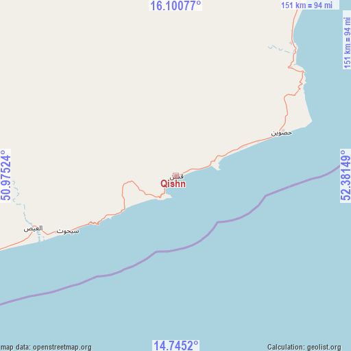
Qishn GPS coordinates[2]
15° 25' 26.724" North, 51° 40' 42.096" East
| Map corner | latitude | longitude |
|---|---|---|
| Upper-left | 16.10077°, | 50.97524° |
| Center: | 15.42409°, | 51.67836° |
| Lower-right: | 14.7452°, | 52.38149° |
| Map W x H: | 150.7×150.7 km | = 93.6×93.6mi |
| max Lat: | 17.76999° ⇑38% North |
| Qishn: | 15.42409° |
| min Lat: | ⇓62% South 12.18576° |
| min Long | Qishn | max Long |
| 42.67107° | 51.67836° | 54.01895° |
| W 97.4%⇐ | ⇒2.6% E |
Elevation
Elevation of Qishn is 8 m = 26 ft, and this is 1296.8 m = 4255 ft below average elevation for this country.
| Max E: |
2791 m = 9157 ft | 98.7% |
| Avg. | 1304.8 m = 4281 ft | |
| Qishn | 8 m = 26 ft | |
Min E: |
4 m = 13 ft | 1.3% |
See also: Yemen elevation on elevation.city.
Geographical zone
Qishn is located in North Torrid zone (between Equator and Tropic of Cancer). Distance of this Northern Tropic circle is 890.9 km =553.6 mi to North.| Distance of | km | miles | from Qishn |
|---|---|---|---|
| North Pole | 8292.1 | 5152.5 | to North |
| Arctic Circle | 5686.2 | 3533.2 | to North |
| Tropic Cancer | 890.9 | 553.6 | to North |
| Equator | 1715 | 1065.7 | to South |


Nearby cities:
15 places around Qishn: (largest is in red/bold)
• Ad Dīs ash Sharqīyah
194.3 km =120.7 mi,  252°
252°
• Al Bilād
267.4 km =166.2 mi,  287°
287°
• Al Ghayz̧ah
102.1 km =63.4 mi,  31°
31°
• Al Qurḩ
147.1 km =91.4 mi,  351°
351°
• Ar Raydah
135.7 km =84.3 mi, 251°
• Ash Shiḩr
234.5 km =145.7 mi, 251°
• Bi’r Ḩāt
215.7 km =134 mi,  11°
11°
• Daḩasuways
107 km =66.5 mi, 288°
• Ghayl Bā Wazīr
258.5 km =160.6 mi, 253°
• Rumāh
254.5 km =158.1 mi,  332°
332°
• Sayḩūt
52.1 km =32.4 mi,  242°
242°
• Shiḩan as Suflá
274.8 km =170.8 mi,  18°
18°
• Thamūd
279.9 km =173.9 mi,  317°
317°
• Ḩawf
197.7 km =122.8 mi,  47°
47°
• Ḩaşwayn
48.9 km =30.4 mi,  67°
67°
Sources, notices
• [Note1] Compared only with cities in Yemen existing in our database
• [Src1] Map data: © OpenStreetMap contributors (CC-BY-SA)
• [Src2] Other city data from geonames.org with taken over terms of usage.
• [Src3] Geographical zone / Annual Mean Temperature by Robert A. Rohde @ Wikipedia
