Shiḩan as Suflá geodata
Shiḩan as Suflá (Al Mahrah) is a seat of a second-order administrative division; located in Yemen in Asia/Aden (GMT+3) time zone. In our database, there are 51 cities with bigger population. Compared to other cities in Yemen, 100% of cities are located further ↓South; 99% of cities are located further ←West and 79.2% of cities have higher elevation than Shiḩan as Suflá. Note1


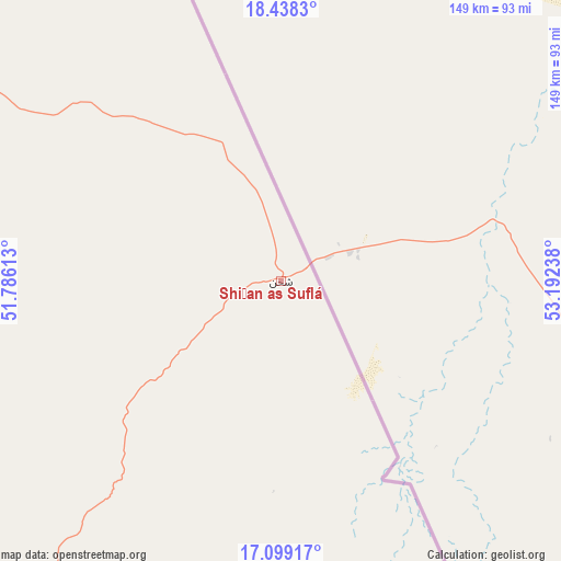
Shiḩan as Suflá GPS coordinates[2]
17° 46' 11.964" North, 52° 29' 21.3" East
| Map corner | latitude | longitude |
|---|---|---|
| Upper-left | 18.4383°, | 51.78613° |
| Center: | 17.76999°, | 52.48925° |
| Lower-right: | 17.09917°, | 53.19238° |
| Map W x H: | 148.9×148.9 km | = 92.5×92.5mi |
| max Lat: | 17.76999° ⇑0% North |
| Shiḩan as Suflá: | 17.76999° |
| min Lat: | ⇓100% South 12.18576° |
| min Long | Shiḩan as Suf | max Long |
| 42.67107° | 52.48925° | 54.01895° |
| W 99%⇐ | ⇒1% E |
Elevation
Elevation of Shiḩan as Suflá is 545 m = 1788 ft, and this is 759.8 m = 2493 ft below average elevation for this country.
| Max E: |
2791 m = 9157 ft | 79.2% |
| Avg. | 1304.8 m = 4281 ft | |
| Shiḩan as Suflá | 545 m = 1788 ft | |
Min E: |
4 m = 13 ft | 20.8% |
See also: Yemen elevation on elevation.city.
Geographical zone
Shiḩan as Suflá is located in North Torrid zone (between Equator and Tropic of Cancer). Distance of this Northern Tropic circle is 630.1 km =391.5 mi to North.| Distance of | km | miles | from Shiḩan as Suflá |
|---|---|---|---|
| North Pole | 8031.2 | 4990.4 | to North |
| Arctic Circle | 5425.3 | 3371.1 | to North |
| Tropic Cancer | 630.1 | 391.5 | to North |
| Equator | 1975.8 | 1227.7 | to South |


Nearby cities:
15 places around Shiḩan as Suflá: (largest is in red/bold)
• Ad Dīs ash Sharqīyah
418 km =259.7 mi,  220°
220°
• Al Bilād
385.4 km =239.5 mi,  241°
241°
• Al Ghayz̧ah
176.9 km =109.9 mi,  190°
190°
• Al Qurḩ
157.1 km =97.6 mi, 222°
• Ar Raydah
372.1 km =231.2 mi, 215°
• As Salāsil
414.3 km =257.4 mi,  249°
249°
• Bi’r Ḩāt
65 km =40.4 mi, 219°
• Daḩasuways
294.7 km =183.1 mi, 219°
• Qishn
274.8 km =170.8 mi,  198°
198°
• Rumāh
205.6 km =127.8 mi,  260°
260°
• Sayḩūt
314 km =195.1 mi, 204°
• Tarīm
417.3 km =259.3 mi, 242°
• Thamūd
277.6 km =172.5 mi, 258°
• Ḩawf
138.9 km =86.3 mi,  155°
155°
• Ḩaşwayn
245.8 km =152.7 mi, 189°
Sources, notices
• [Note1] Compared only with cities in Yemen existing in our database
• [Src1] Map data: © OpenStreetMap contributors (CC-BY-SA)
• [Src2] Other city data from geonames.org with taken over terms of usage.
• [Src3] Geographical zone / Annual Mean Temperature by Robert A. Rohde @ Wikipedia
