Al Ghayz̧ah geodata
Al Ghayz̧ah (Al Mahrah) is a seat of a first-order administrative division; located in Yemen in Asia/Aden (GMT+3) time zone. With population of 10,948 people, there are 25 cities with bigger population in this country. Compared to other cities in Yemen, 87.3% of cities are located further ↓South; 98.4% of cities are located further ←West and 93.8% of cities have higher elevation than Al Ghayz̧ah. Note1


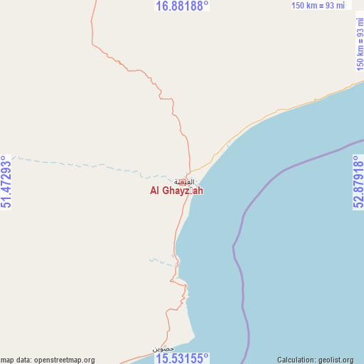
Al Ghayz̧ah GPS coordinates[2]
16° 12' 28.332" North, 52° 10' 33.78" East
| Map corner | latitude | longitude |
|---|---|---|
| Upper-left | 16.88188°, | 51.47293° |
| Center: | 16.20787°, | 52.17605° |
| Lower-right: | 15.53155°, | 52.87918° |
| Map W x H: | 150.1×150.1 km | = 93.3×93.3mi |
| max Lat: | 17.76999° ⇑12.7% North |
| Al Ghayz̧ah: | 16.20787° |
| min Lat: | ⇓87.3% South 12.18576° |
| min Long | Al Ghayz̧ah | max Long |
| 42.67107° | 52.17605° | 54.01895° |
| W 98.4%⇐ | ⇒1.6% E |
Elevation
Elevation of Al Ghayz̧ah is 17 m = 56 ft, and this is 1287.8 m = 4225 ft below average elevation for this country.
| Max E: |
2791 m = 9157 ft | 93.8% |
| Avg. | 1304.8 m = 4281 ft | |
| Al Ghayz̧ah | 17 m = 56 ft | |
Min E: |
4 m = 13 ft | 6.2% |
See also: Yemen elevation on elevation.city.
Geographical zone
Al Ghayz̧ah is located in North Torrid zone (between Equator and Tropic of Cancer). Distance of this Northern Tropic circle is 803.8 km =499.5 mi to North.| Distance of | km | miles | from Al Ghayz̧ah |
|---|---|---|---|
| North Pole | 8204.9 | 5098.3 | to North |
| Arctic Circle | 5599 | 3479.1 | to North |
| Tropic Cancer | 803.8 | 499.5 | to North |
| Equator | 1802.1 | 1119.8 | to South |


Nearby cities:
15 places around Al Ghayz̧ah: (largest is in red/bold)
• Ad Dīs ash Sharqīyah
278.9 km =173.3 mi,  238°
238°
• Al Bilād
308.1 km =191.4 mi,  268°
268°
• Al Qurḩ
94.2 km =58.5 mi,  308°
308°
• Ar Raydah
223.7 km =139 mi,  234°
234°
• Ash Shiḩr
319 km =198.2 mi, 239°
• Bi’r Ḩāt
124.2 km =77.2 mi,  356°
356°
• Daḩasuways
163.7 km =101.7 mi,  250°
250°
• Qishn
102.1 km =63.4 mi,  211°
211°
• Rumāh
219.5 km =136.4 mi, 309°
• Sayḩūt
149 km =92.6 mi,  221°
221°
• Shiḩan as Suflá
176.9 km =109.9 mi,  10°
10°
• Tarīm
339.8 km =211.1 mi, 267°
• Thamūd
268.8 km =167 mi,  296°
296°
• Ḩawf
103 km =64 mi,  62°
62°
• Ḩaşwayn
69.1 km =42.9 mi,  186°
186°
Sources, notices
• [Note1] Compared only with cities in Yemen existing in our database
• [Src1] Map data: © OpenStreetMap contributors (CC-BY-SA)
• [Src2] Other city data from geonames.org with taken over terms of usage.
• [Src3] Geographical zone / Annual Mean Temperature by Robert A. Rohde @ Wikipedia
