Al Khirāb geodata
Al Khirāb (Al Jawf) is a seat of a second-order administrative division; located in Yemen in Asia/Aden (GMT+3) time zone. In our database, there are 51 cities with bigger population. Compared to other cities in Yemen, 92.2% of cities are located further ↓South; 52.3% of cities are located further →East and 53.6% of cities have lower elevation than Al Khirāb. Note1


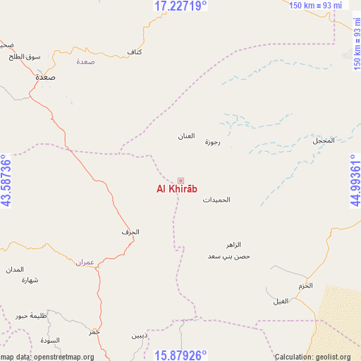
Al Khirāb GPS coordinates[2]
16° 33' 15.84" North, 44° 17' 25.728" East
| Map corner | latitude | longitude |
|---|---|---|
| Upper-left | 17.22719°, | 43.58736° |
| Center: | 16.5544°, | 44.29048° |
| Lower-right: | 15.87926°, | 44.99361° |
| Map W x H: | 149.9×149.9 km | = 93.1×93.1mi |
| max Lat: | 17.76999° ⇑7.8% North |
| Al Khirāb: | 16.5544° |
| min Lat: | ⇓92.2% South 12.18576° |
| min Long | Al Khirāb | max Long |
| 42.67107° | 44.29048° | 54.01895° |
| W 47.7%⇐ | ⇒52.3% E |
Elevation
Elevation of Al Khirāb is 1380 m = 4528 ft, and this is 75.2 m = 247 ft above average elevation for this country.
| Max E: |
2791 m = 9157 ft | 46.4% |
| Al Khirāb | 1380 m 4528 ft | |
| Avg. | 1304.8 m = 4281 ft | |
Min E: |
4 m = 13 ft | 53.6% |
See also: Yemen elevation on elevation.city.
Geographical zone
Al Khirāb is located in North Torrid zone (between Equator and Tropic of Cancer). Distance of this Northern Tropic circle is 765.2 km =475.5 mi to North.| Distance of | km | miles | from Al Khirāb |
|---|---|---|---|
| North Pole | 8166.4 | 5074.4 | to North |
| Arctic Circle | 5560.5 | 3455.1 | to North |
| Tropic Cancer | 765.2 | 475.5 | to North |
| Equator | 1840.7 | 1143.8 | to South |


Nearby cities:
15 places around Al Khirāb: (largest is in red/bold)
• Al Matūn
47.8 km =29.7 mi,  138°
138°
• Al Maşlūb
54.7 km =34 mi, 139°
• Al Maḩjal
61.9 km =38.5 mi,  73°
73°
• Al Qaflah
61.6 km =38.3 mi,  244°
244°
• Al Ḩarf
29.8 km =18.5 mi,  224°
224°
• Al Ḩashwah
39.2 km =24.4 mi,  357°
357°
• Al Ḩumaydāt
16.7 km =10.4 mi,  117°
117°
• Al ‘Ashshah
57.1 km =35.5 mi,  234°
234°
• Al ‘Inān
18.8 km =11.7 mi,  7°
7°
• Ash Shawātī
56.9 km =35.4 mi,  296°
296°
• Az Zāhir
34.2 km =21.3 mi, 140°
• Kitāf
56.5 km =35.1 mi,  340°
340°
• Rajūzah
20.9 km =13 mi,  39°
39°
• Ḩişn Banī Sa‘d
37.1 km =23.1 mi,  147°
147°
• Ḩūth
49.7 km =30.9 mi, 223°
Sources, notices
• [Note1] Compared only with cities in Yemen existing in our database
• [Src1] Map data: © OpenStreetMap contributors (CC-BY-SA)
• [Src2] Other city data from geonames.org with taken over terms of usage.
• [Src3] Geographical zone / Annual Mean Temperature by Robert A. Rohde @ Wikipedia
