Mondlo geodata
Mondlo (KwaZulu-Natal) is a populated place; located in South Africa in Africa/Johannesburg (GMT+2) time zone. With population of 44,922 people, there are 97 cities with bigger population in this country. Compared to other cities in South Africa, 56.9% of cities are located further ↓South; 89.1% of cities are located further ←West and 52.8% of cities have lower elevation than Mondlo. Note1
Administrative division(s):
- Level 1: KwaZulu-Natal
- Level 2: Zululand District Municipality
- Level 3: Abaqulusi


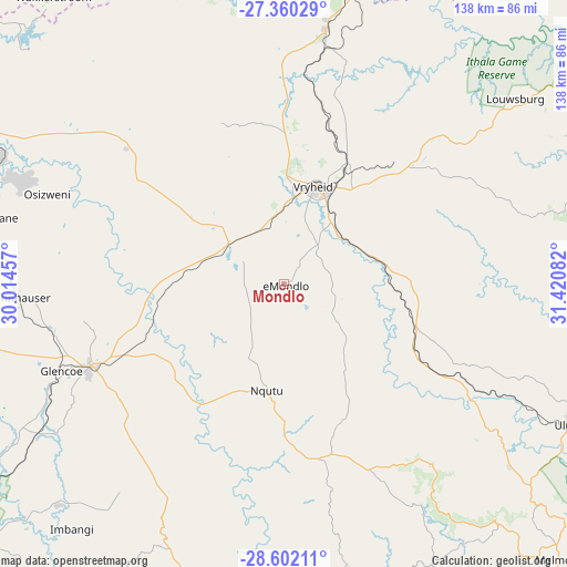
Mondlo GPS coordinates[2]
27° 58' 58.764" South, 30° 43' 3.684" East
| Map corner | latitude | longitude |
|---|---|---|
| Upper-left | -27.36029°, | 30.01457° |
| Center: | -27.98299°, | 30.71769° |
| Lower-right: | -28.60211°, | 31.42082° |
| Map W x H: | 138.1×138.1 km | = 85.8×85.8mi |
| max Lat: | -22.34881° ⇑43.1% North |
| Mondlo: | -27.98299° |
| min Lat: | ⇓56.9% South -34.66739° |
| min Long | Mondlo | max Long |
| 16.8697° | 30.71769° | 32.26762° |
| W 89.1%⇐ | ⇒10.9% E |
Elevation
Elevation of Mondlo is 1155 m = 3789 ft, and this is 185.4 m = 608 ft above average elevation for this country.
| Max E: |
1873 m = 6145 ft | 47.2% |
| Mondlo | 1155 m 3789 ft | |
| Avg. | 969.6 m = 3181 ft | |
Min E: |
7 m = 23 ft | 52.8% |
See also: Mondlo elevation on elevation.city.
Geographical zone
Mondlo is located in South temperate zone (between Tropic of Capricorn and the Antarctic Circle). Distance of this Southern Tropic circle is 505.5 km =314.1 mi to North.| Distance of | km | miles | from Mondlo |
|---|---|---|---|
| Equator | 3111.4 | 1933.3 | to North |
| Tropic Capricorn | 505.5 | 314.1 | to North |
| Antarctic Circle | 4289.8 | 2665.6 | to South |
| South Pole | 6895.6 | 4284.7 | to South |


Nearby cities:
15 places around Mondlo: (largest is in red/bold)
• Dannhauser
65 km =40.4 mi,  266°
266°
• Dundee
51.7 km =32.1 mi,  246°
246°
• Ekuvukeni
77.1 km =47.9 mi,  225°
225°
• Glencoe
60 km =37.3 mi, 248°
• Melmoth
94.6 km =58.8 mi,  135°
135°
• Newcastle
81.2 km =50.5 mi,  287°
287°
• Nkandla
79.8 km =49.6 mi,  152°
152°
• Nongoma
91.8 km =57 mi,  84°
84°
• Paulpietersburg
62.9 km =39.1 mi,  8°
8°
• Piet Retief
108.9 km =67.7 mi,  4°
4°
• Tugela Ferry
88.8 km =55.2 mi,  197°
197°
• Ulundi
78.9 km =49 mi,  119°
119°
• Utrecht
53.1 km =33 mi,  312°
312°
• Volksrust
107.2 km =66.6 mi, 309°
• Vryheid
24.8 km =15.4 mi,  17°
17°
Sources, notices
• [Note1] Compared only with cities in South Africa existing in our database
• [Src1] Map data: © OpenStreetMap contributors (CC-BY-SA)
• [Src2] Other city data from geonames.org with taken over terms of usage.
• [Src3] Geographical zone / Annual Mean Temperature by Robert A. Rohde @ Wikipedia
